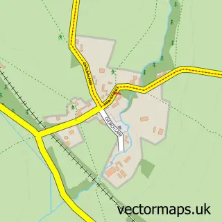
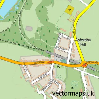
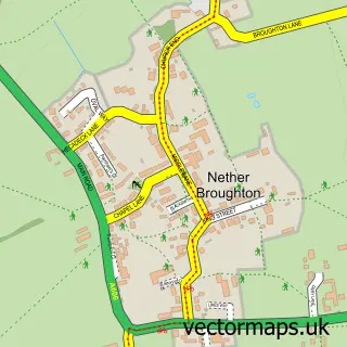
This Ab Kettleby street map is a detailed vector street map covering a 750m x 750m area. Select a larger area to create and download your own vector street map of Ab Kettleby.
The 750-metre map sample for Ab Kettleby covers 123 mapped buildings and approximately 18.8 km of road detail, of which 11 named roads are named. The immediate area includes 1 school, 2 pubs and 1 MOT station within 2 miles. The wider area around Ab Kettleby features 2 food and drink venues. To create a larger or custom map of Ab Kettleby, the map builder lets you define your own coverage area and download editable SVG, PDF and PNG files.
Create a larger editable map of Ab Kettleby
Choose any area you need and generate a high-quality vector map instantly. Perfect for print, planning, design, business and personal use.

This Ab Kettleby street map in Leicestershire is available as downloadable SVG, PDF and PNG map files, or as a printed map for planning, business, display, education, local information and design work. You can also create a larger custom map area using the map selector.
What this Ab Kettleby map sample shows
Ab Kettleby lies within Ab Kettleby Cp parish, part of Old Dalby ward in the Melton District (B) local authority area. The postcode geography for this area includes the LE postcode area, the LE14 postcode district and the LE14 3 postcode sector. Residents fall under the Nhs Leicester, Leicestershire And Rutland Integrated Care Board for NHS services.
Local features near Ab Kettleby
Within 2 milesAmenities and services in and around Ab Kettleby.
Administrative and postcode information for Ab Kettleby
Ab Kettleby lies within Ab Kettleby Cp parish, part of Old Dalby ward in the Melton District (B) local authority area. The postcode geography for this area includes the LE postcode area, the LE14 postcode district and the LE14 3 postcode sector. Residents fall under the Nhs Leicester, Leicestershire And Rutland Integrated Care Board for NHS services.
Nearby street map samples around Ab Kettleby

More street maps in Leicestershire
750 metre map area coverage
Boundary, postcode and point of interest information for the 750m x 750m rectangle centred on this sample map.
Boundaries containing map centre
Constituency: Melton and Syston Co Const
County: Leicestershire County
District: Melton District (B)
Icb: NHS Leicester Leicestershire and Rutland ICB
Parish: Ab Kettleby CP
Police Force: leicestershire
Postcode District: LE14
Postcode Sector: LE14 3
Ward: Old Dalby Ward
Nearby boundaries intersecting sample
No additional intersecting boundaries found.
Postcode coverage
POI category counts
Contractor: 2
Professional Services: 2
Pub: 2
Retail: 2
Anglican Church: 1
Automotive Repair: 1
Car Dealer: 1
Church Cathedral: 1
Elementary School: 1
Fence And Gate Sales Service: 1
Sample points of interest
- Ab Kettleby: St James
- Unipart Car Care Centre
- Belvoir Classic Cars
- St James's Church
- Y. Clayton Building Contractors
- Y. Clayton Building Contractors
- Ab Kettleby Primary School
- Fencescape Solutions
- Riverford Home Delivery
- Kettleby Kitchen
- Ads Tools & Pumps
- Welby lodge-ings small animal boarding
Create a larger editable map of Ab Kettleby
This sample shows only a 750 metre area. To create a larger map of Ab Kettleby, use our map builder to choose your own coverage area, add titles and download editable SVG, PDF and PNG files.
Create a custom map of Ab Kettleby