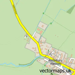
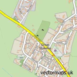
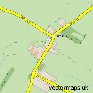
This Alconbury street map is a detailed vector street map covering a 750m x 750m area. Select a larger area to create and download your own vector street map of Alconbury.
The 750-metre map sample for Alconbury covers 358 mapped buildings and approximately 19.6 km of road detail, of which 39 named roads are named. The immediate area includes 1 school, 1 GP surgery within 2 miles and 2 MOT stations within 2 miles. The wider area around Alconbury features 1 food and drink venue and 1 hotel. To create a larger or custom map of Alconbury, the map builder lets you define your own coverage area and download editable SVG, PDF and PNG files.
Create a larger editable map of Alconbury
Choose any area you need and generate a high-quality vector map instantly. Perfect for print, planning, design, business and personal use.

This Alconbury street map in Cambridgeshire is available as downloadable SVG, PDF and PNG map files, or as a printed map for planning, business, display, education, local information and design work. You can also create a larger custom map area using the map selector.
What this Alconbury map sample shows
Alconbury lies within Alconbury Cp parish, part of Alconbury ward in the Huntingdonshire District local authority area. The postcode geography for this area includes the PE postcode area, the PE28 postcode district and the PE28 4 postcode sector. Residents fall under the Nhs Cambridgeshire And Peterborough Integrated Care Board for NHS services.
Local features near Alconbury
Within 2 milesAmenities and services in and around Alconbury.
Administrative and postcode information for Alconbury
Alconbury lies within Alconbury Cp parish, part of Alconbury ward in the Huntingdonshire District local authority area. The postcode geography for this area includes the PE postcode area, the PE28 postcode district and the PE28 4 postcode sector. Residents fall under the Nhs Cambridgeshire And Peterborough Integrated Care Board for NHS services.
Nearby street map samples around Alconbury

More street maps in Cambridgeshire
750 metre map area coverage
Boundary, postcode and point of interest information for the 750m x 750m rectangle centred on this sample map.
Boundaries containing map centre
Constituency: Huntingdon Co Const
County: Cambridgeshire County
District: Huntingdonshire District
Icb: NHS Central East ICB
Parish: Alconbury CP
Police Force: cambridgeshire
Postcode District: PE28
Postcode Sector: PE28 4
Ward: Alconbury Ward
Nearby boundaries intersecting sample
No additional intersecting boundaries found.
Postcode coverage
POI category counts
Church Cathedral: 2
Elementary School: 2
Grocery Store: 2
Professional Services: 2
Agricultural Service: 1
Atms: 1
Bed And Breakfast: 1
Commercial Real Estate: 1
Construction Services: 1
Contractor: 1
Sample points of interest
- Hall Agriculture Ltd
- Nisa (Protected), Alconbury
- Spring Cottage
- Alconbury Church
- St Peter & St Paul
- Huntingdon Pump Company Ltd.
- Your Vision Property Solutions Ltd
- Brookview Glaziers
- Gainfort Ltd.
- Alconbury Church of England Primary School
- Alconbury Primary School
- Fire Safety Management Services
Create a larger editable map of Alconbury
This sample shows only a 750 metre area. To create a larger map of Alconbury, use our map builder to choose your own coverage area, add titles and download editable SVG, PDF and PNG files.
Create a custom map of Alconbury