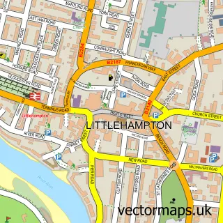
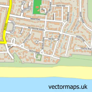
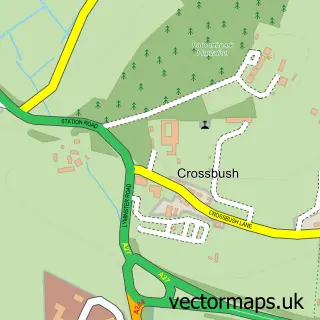
This Angmering street map is a detailed vector street map covering a 750m x 750m area. Select a larger area to create and download your own vector street map of Angmering.
The 750-metre map sample for Angmering covers 478 mapped buildings and approximately 17.1 km of road detail, of which 36 named roads are named. The immediate area includes 1 school, 4 GP surgeries within 2 miles, 2 pubs and 1 MOT station, with 11 within 2 miles. The wider area around Angmering features 1 tourism point of interest, 2 food and drink venues and 2 hotels. To create a larger or custom map of Angmering, the map builder lets you define your own coverage area and download editable SVG, PDF and PNG files.
Create a larger editable map of Angmering
Choose any area you need and generate a high-quality vector map instantly. Perfect for print, planning, design, business and personal use.

This Angmering street map in West Sussex is available as downloadable SVG, PDF and PNG map files, or as a printed map for planning, business, display, education, local information and design work. You can also create a larger custom map area using the map selector.
What this Angmering map sample shows
Angmering lies within Angmering Cp parish, part of Angmering & Findon ward in the Arun District local authority area. The postcode geography for this area includes the BN postcode area, the BN16 postcode district and the BN16 4 postcode sector. Residents fall under the Nhs Sussex Integrated Care Board for NHS services.
Local features near Angmering
Within 2 milesAmenities and services in and around Angmering.
Administrative and postcode information for Angmering
The local authority covering Angmering is Arun District, within the county of West Sussex. The settlement lies within Angmering & Findon ward and Angmering Cp civil parish. The BN16 postcode district and BN16 4 postcode sector serve the immediate area. NHS provision in the area is delivered through University Hospitals Sussex Nhs Foundation Trust.
Nearby street map samples around Angmering

More street maps in West Sussex
750 metre map area coverage
Boundary, postcode and point of interest information for the 750m x 750m rectangle centred on this sample map.
Boundaries containing map centre
Constituency: Worthing West Co Const
County: West Sussex County
District: Arun District
Icb: NHS Surrey and Sussex ICB
Parish: Angmering CP
Police Force: sussex
Postcode District: BN16
Postcode Sector: BN16 4
Ward: Angmering & Findon Ward
Nearby boundaries intersecting sample
No additional intersecting boundaries found.
Postcode coverage
POI category counts
Hair Salon: 4
Car Dealer: 2
Church Cathedral: 2
Contractor: 2
Craft Shop: 2
Event Planning: 2
Florist: 2
Grocery Store: 2
Pharmacy: 2
Professional Services: 2
Sample points of interest
- Dance Beat Studio Sally Parkinson
- Atlas Lofts
- Graham Butt Estate & Letting Agents Angmering
- The Southern Co-Operative Angmering The Square
- Arundel Road RizzCar Garage Ltd
- The Angmering Club
- The Barber Shop Angmering
- Moore at the Manor Hairdressing
- Stephanie at Angmering manor
- Angmering Cycles
- The book nook corner - Independent Usborne Organiser
- East West Bakery
Create a larger editable map of Angmering
This sample shows only a 750 metre area. To create a larger map of Angmering, use our map builder to choose your own coverage area, add titles and download editable SVG, PDF and PNG files.
Create a custom map of Angmering