Vector Maps logo
Home Why it works Popular maps Districts Samples Customizer Create Your Map
VectorMaps.uk
Home Popular maps Districts Samples Customizer Create Your Map Privacy Disclaimer
Home / UK Maps / Ayrshire and Arran / Annbank Map

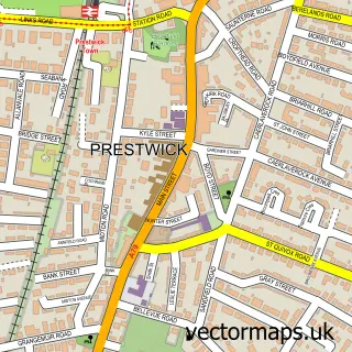
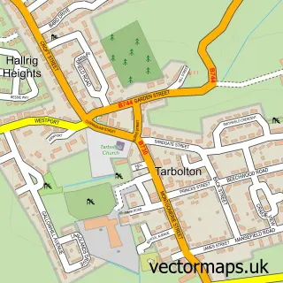
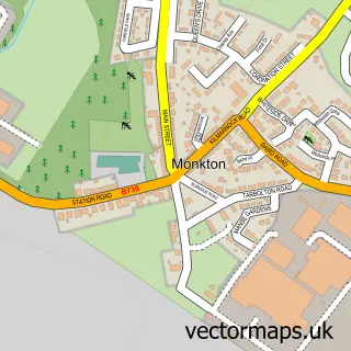
This Annbank street map is a detailed vector street map covering a 750m x 750m area. Select a larger area to create and download your own vector street map of Annbank.

Annbank is a village in Ayrshire And Arran, in the South Scotland of Scotland. Historically, the area formed part of Ayrshire. The settlement falls within the Central Ayrshire parliamentary constituency. It is served by the KA6 postcode district, with KA6

The 750-metre map sample for Annbank covers 169 mapped buildings and approximately 6.2 km of road detail, of which 12 named roads are named. The wider area around Annbank features 2 campsites within 2 miles. To create a larger or custom map of Annbank, the map builder lets you define your own coverage area and download editable SVG, PDF and PNG files.

169Buildings
6.18 kmRoads
12Named roads
0Residents within 2 miles
Create your own

Create a larger editable map of Annbank

Choose any area you need and generate a high-quality vector map instantly. Perfect for print, planning, design, business and personal use.

Choose any location
Editable SVG files
Any size up to A0
PDF, PNG & more
Instant download
High quality guaranteed
Create My Custom Map
Secure, private & no credit card required
Annbank Vector Street Map
750m Sample
Annbank vector street map sample showing roads, buildings and local features in a 750 metre preview area
Buy Annbank Map Print from £12.95 Buy Annbank Digital Map from £6

This Annbank street map in Ayrshire and Arran is available as downloadable SVG, PDF and PNG map files, or as a printed map for planning, business, display, education, local information and design work. You can also create a larger custom map area using the map selector.

What this Annbank map sample shows

Annbank lies within South Ayrshire parish, part of Kyle ward in the South Ayrshire local authority area. The postcode geography for this area includes the KA postcode area, the KA6 postcode district and the KA6 5 postcode sector. Residents fall under the Ayrshire And Arran for NHS services.

Local features near Annbank

Within 2 miles

Amenities and services in and around Annbank.

2 Campsites within 2 miles

Counts are approximate and based on publicly available data.

Administrative and postcode information for Annbank

Annbank lies within South Ayrshire parish, part of Kyle ward in the South Ayrshire local authority area. The postcode geography for this area includes the KA postcode area, the KA6 postcode district and the KA6 5 postcode sector. Residents fall under the Ayrshire And Arran for NHS services.

Parish SOUTH AYRSHIRE
Ward Kyle
District / local authority South Ayrshire
County Ayrshire and Arran
Historic county Ayrshire
Postcode district KA6
Postcode sector KA6 5
Parliamentary constituency Central Ayrshire
Region South Scotland
Country Scotland

Nearby street map samples around Annbank

Street map sample of Prestwick, Ayrshire and Arran Prestwick Town - Ayrshire and Arran - 3.8 miles Street map sample of Glasgow, City of Glasgow Glasgow City - City of Glasgow - 28.7 miles Street map sample of Mossblown, Ayrshire and Arran Mossblown Village - Ayrshire and Arran - 1.0 miles Street map sample of St Quivox, Ayrshire and Arran St Quivox Village - Ayrshire and Arran - 2.0 miles Street map sample of Coylton, Ayrshire and Arran Coylton Village - Ayrshire and Arran - 2.0 miles Street map sample of Tarbolton, Ayrshire and Arran Tarbolton Village - Ayrshire and Arran - 2.9 miles Street map sample of Coalhall, Ayrshire and Arran Coalhall Village - Ayrshire and Arran - 3.0 miles Street map sample of Drongan, Ayrshire and Arran Drongan Village - Ayrshire and Arran - 3.8 miles Street map sample of Failford, Ayrshire and Arran Failford Village - Ayrshire and Arran - 3.8 miles Street map sample of Monkton, Ayrshire and Arran Monkton Village - Ayrshire and Arran - 4.2 miles

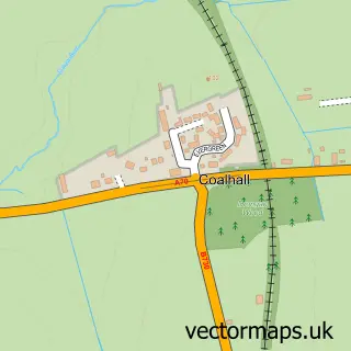
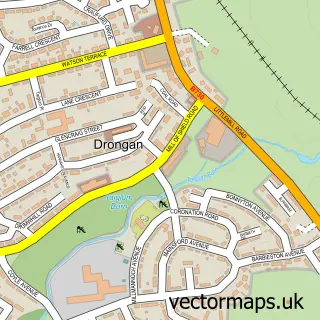
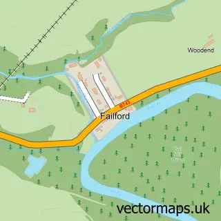
More street maps in Ayrshire and Arran

Street map sample of Mossblown, Ayrshire and Arran Mossblown Village - 1.0 miles Street map sample of St Quivox, Ayrshire and Arran St Quivox Village - 2.0 miles Street map sample of Coylton, Ayrshire and Arran Coylton Village - 2.0 miles Street map sample of Tarbolton, Ayrshire and Arran Tarbolton Village - 2.9 miles Street map sample of Coalhall, Ayrshire and Arran Coalhall Village - 3.0 miles

750 metre map area coverage

Boundary, postcode and point of interest information for the 750m x 750m rectangle centred on this sample map.

Boundaries containing map centre

Constituency: Central Ayrshire Co Const

District: South Ayrshire

Icb: Ayrshire and Arran

Postcode District: KA6

Postcode Sector: KA6 5

Ward: Kyle Ward

Nearby boundaries intersecting sample

Constituency: Ayr, Carrick and Cumnock Co Const

Ward: Maybole, North Carrick and Coylton Ward

Postcode coverage

KA6 KA6 5

POI category counts

Shipping Center: 3

Community Center: 2

Convenience Store: 2

Sports Club And League: 2

Airport Shuttles: 1

Atms: 1

Carpenter: 1

Community Services Non Profits: 1

Food Stand: 1

Football Stadium: 1

Sample points of interest

  • A To B Taxis Ayr Airport Shuttles
  • PayPoint Atms
  • Hamilton Home Improvements Ayrshire Carpenter
  • Annbank Community Association Community Center
  • Annbank Village Hall Community Center
  • Night Before Christmas Campaign Community Services Non Profits
  • Braefoot Stores Convenience Store
  • Premier Braefoot Conv Store Convenience Store
  • Wulyum’s ltd Food Stand
  • New Pebble Park Football Stadium
  • Premier Korean Grocery Store
  • Annbank Post Office Shipping Center

Create a larger editable map of Annbank

This sample shows only a 750 metre area. To create a larger map of Annbank, use our map builder to choose your own coverage area, add titles and download editable SVG, PDF and PNG files.

Create a custom map of Annbank

Phone 01751 473136 | Copyright Vectormaps.uk 2026

Samples Customizer Privacy Disclaimer
Annbank Vector Street Map
Annbank enlarged street map sample showing a 750 metre preview area