Vector Maps logo
Home Why it works Popular maps Districts Samples Customizer Create Your Map
VectorMaps.uk
Home Popular maps Districts Samples Customizer Create Your Map Privacy Disclaimer
Home / UK Maps / Ayrshire and Arran / Tarbolton Map

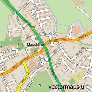
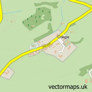
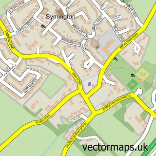
This Tarbolton street map is a detailed vector street map covering a 750m x 750m area. Select a larger area to create and download your own vector street map of Tarbolton.

Tarbolton is a village in Ayrshire And Arran, in the South Scotland of Scotland. Historically, the area formed part of Ayrshire. The settlement falls within the Central Ayrshire parliamentary constituency. It is served by the KA5 postcode district, with K

The 750-metre map sample for Tarbolton covers 363 mapped buildings and approximately 18.5 km of road detail, of which 27 named roads are named. The immediate area includes 2 pubs and 1 MOT station. The wider area around Tarbolton features 1 tourism point of interest and 5 food and drink venues. To create a larger or custom map of Tarbolton, the map builder lets you define your own coverage area and download editable SVG, PDF and PNG files.

363Buildings
18.48 kmRoads
27Named roads
0Residents within 2 miles
Create your own

Create a larger editable map of Tarbolton

Choose any area you need and generate a high-quality vector map instantly. Perfect for print, planning, design, business and personal use.

Choose any location
Editable SVG files
Any size up to A0
PDF, PNG & more
Instant download
High quality guaranteed
Create My Custom Map
Secure, private & no credit card required
Tarbolton Vector Street Map
750m Sample
Tarbolton vector street map sample showing roads, buildings and local features in a 750 metre preview area
Buy Tarbolton Map Print from £12.95 Buy Tarbolton Digital Map from £6

This Tarbolton street map in Ayrshire and Arran is available as downloadable SVG, PDF and PNG map files, or as a printed map for planning, business, display, education, local information and design work. You can also create a larger custom map area using the map selector.

What this Tarbolton map sample shows

Tarbolton lies within South Ayrshire parish, part of Kyle ward in the South Ayrshire local authority area. The postcode geography for this area includes the KA postcode area, the KA5 postcode district and the KA5 5 postcode sector. Residents fall under the Ayrshire And Arran for NHS services.

Local features near Tarbolton

Within 2 miles

Amenities and services in and around Tarbolton.

1 MOT stations 1 within 2 miles
1 Tourism & leisure
5 Food & drink
2 Pubs
1 Healthcare POIs
2 Vehicle services

Counts are approximate and based on publicly available data.

Administrative and postcode information for Tarbolton

The local authority covering Tarbolton is South Ayrshire, within the county of Ayrshire And Arran. The settlement lies within Kyle ward and South Ayrshire civil parish. The KA5 postcode district and KA5 5 postcode sector serve the immediate area. NHS provision in the area is delivered through Ayrshire And Arran.

Parish SOUTH AYRSHIRE
Ward Kyle
District / local authority South Ayrshire
County Ayrshire and Arran
Historic county Ayrshire
Postcode district KA5
Postcode sector KA5 5
Parliamentary constituency Central Ayrshire
Region South Scotland
Country Scotland

Nearby street map samples around Tarbolton

Street map sample of Mauchline, Ayrshire and Arran Mauchline Town - Ayrshire and Arran - 4.2 miles Street map sample of Glasgow, City of Glasgow Glasgow City - City of Glasgow - 25.7 miles Street map sample of Failford, Ayrshire and Arran Failford Village - Ayrshire and Arran - 1.9 miles Street map sample of Mossblown, Ayrshire and Arran Mossblown Village - Ayrshire and Arran - 2.4 miles Street map sample of Annbank, Ayrshire and Arran Annbank Village - Ayrshire and Arran - 2.9 miles Street map sample of Craigie, Ayrshire and Arran Craigie Village - Ayrshire and Arran - 3.2 miles Street map sample of Hansel Village, Ayrshire and Arran Hansel Village Village - Ayrshire and Arran - 3.6 miles Street map sample of Bogend, Ayrshire and Arran Bogend Village - Ayrshire and Arran - 3.7 miles Street map sample of St Quivox, Ayrshire and Arran St Quivox Village - Ayrshire and Arran - 3.9 miles Street map sample of Symington, Ayrshire and Arran Symington Village - Ayrshire and Arran - 3.9 miles

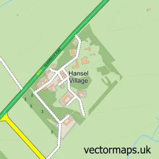
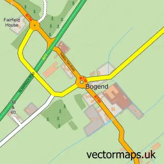
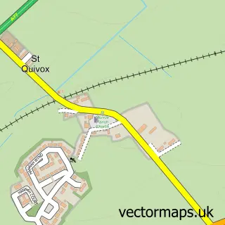
More street maps in Ayrshire and Arran

Street map sample of Failford, Ayrshire and Arran Failford Village - 1.9 miles Street map sample of Mossblown, Ayrshire and Arran Mossblown Village - 2.4 miles Street map sample of Annbank, Ayrshire and Arran Annbank Village - 2.9 miles Street map sample of Craigie, Ayrshire and Arran Craigie Village - 3.2 miles Street map sample of Hansel Village, Ayrshire and Arran Hansel Village Village - 3.6 miles

750 metre map area coverage

Boundary, postcode and point of interest information for the 750m x 750m rectangle centred on this sample map.

Boundaries containing map centre

Constituency: Central Ayrshire Co Const

District: South Ayrshire

Icb: Ayrshire and Arran

Postcode District: KA5

Postcode Sector: KA5 5

Ward: Kyle Ward

Nearby boundaries intersecting sample

No additional intersecting boundaries found.

Postcode coverage

KA5 KA5 5

POI category counts

Convenience Store: 3

Automotive Repair: 2

Beauty And Spa: 2

Pub: 2

Restaurant: 2

Agricultural Service: 1

Atms: 1

Bakery: 1

Bar: 1

Bar And Grill Restaurant: 1

Sample points of interest

  • Hamilton Brothers Agricultural Service
  • Keystore Atms
  • Croft Service Station Automotive Repair
  • Croft Service Station Automotive Repair
  • Poli R Bakery
  • Masonic Lodge & Museum Bar
  • The Heights Bar & Grill Bar And Grill Restaurant
  • Lashes & Brows by Lucinda Beauty And Spa
  • Number 5 Hair & Beauty Beauty And Spa
  • Eclipse Hair Studio Beauty Salon
  • James Wylie & Son Building Supply Store
  • M&A Food To Go Cafe

Create a larger editable map of Tarbolton

This sample shows only a 750 metre area. To create a larger map of Tarbolton, use our map builder to choose your own coverage area, add titles and download editable SVG, PDF and PNG files.

Create a custom map of Tarbolton

Phone 01751 473136 | Copyright Vectormaps.uk 2026

Samples Customizer Privacy Disclaimer
Tarbolton Vector Street Map
Tarbolton enlarged street map sample showing a 750 metre preview area