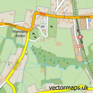
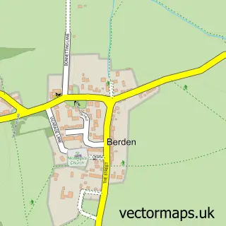
This Arkesden street map is a detailed vector street map covering a 750m x 750m area. Select a larger area to create and download your own vector street map of Arkesden.
The 750-metre map sample for Arkesden covers 109 mapped buildings and approximately 5.8 km of road detail, of which 5 named roads are named. The immediate area includes 1 pub. The wider area around Arkesden features 1 food and drink venue. To create a larger or custom map of Arkesden, the map builder lets you define your own coverage area and download editable SVG, PDF and PNG files.
Create a larger editable map of Arkesden
Choose any area you need and generate a high-quality vector map instantly. Perfect for print, planning, design, business and personal use.

This Arkesden street map in Essex is available as downloadable SVG, PDF and PNG map files, or as a printed map for planning, business, display, education, local information and design work. You can also create a larger custom map area using the map selector.
What this Arkesden map sample shows
Arkesden lies within Arkesden Cp parish, part of Clavering ward in the Uttlesford District local authority area. The postcode geography for this area includes the CB postcode area, the CB11 postcode district and the CB11 4 postcode sector. Residents fall under the Nhs Hertfordshire And West Essex Integrated Care Board for NHS services.
Local features near Arkesden
Within 2 milesAmenities and services in and around Arkesden.
Administrative and postcode information for Arkesden
The local authority covering Arkesden is Uttlesford District, within the county of Essex. The settlement lies within Clavering ward and Arkesden Cp civil parish. The CB11 postcode district and CB11 4 postcode sector serve the immediate area. NHS provision in the area is delivered through Cambridge University Hospitals Nhs Foundation Trust.
Nearby street map samples around Arkesden

More street maps in Essex
750 metre map area coverage
Boundary, postcode and point of interest information for the 750m x 750m rectangle centred on this sample map.
Boundaries containing map centre
Constituency: North West Essex Co Const
County: Essex County
District: Uttlesford District
Icb: NHS Central East ICB
Parish: Arkesden CP
Police Force: essex
Postcode District: CB11
Postcode Sector: CB11 4
Ward: Clavering Ward
Nearby boundaries intersecting sample
No additional intersecting boundaries found.
Postcode coverage
POI category counts
Weight Loss Center: 2
Anglican Church: 1
Bicycle Shop: 1
Clothing Store: 1
Counseling And Mental Health: 1
First Aid Class: 1
Gastropub: 1
Gift Shop: 1
Pub: 1
Supermarket: 1
Sample points of interest
- Arkesden: St Mary the Virgin
- Matec Cycles
- The Costume Company
- Winningminds
- ABC First Aid Training Solutions
- Axe & Compasses
- Made In England, Why go Abroad?
- Axe and Compasses
- Simply Salmon
- Timeless Teas
- 1 Diet
- The 1:1 Diet
Create a larger editable map of Arkesden
This sample shows only a 750 metre area. To create a larger map of Arkesden, use our map builder to choose your own coverage area, add titles and download editable SVG, PDF and PNG files.
Create a custom map of Arkesden