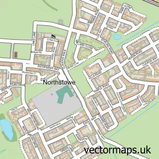
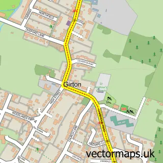
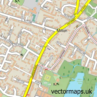
This Cambridge street map is a detailed vector street map covering a 750m x 750m area. Select a larger area to create and download your own vector street map of Cambridge.
The 750-metre map sample for Cambridge covers 105 mapped buildings and approximately 15.5 km of road detail, of which 41 named roads are named. The immediate area includes 1 school, 2 GP surgeries, with 13 within 2 miles, 19 pubs and 22 MOT stations within 2 miles. The wider area around Cambridge features 26 tourism points of interest, 103 food and drink venues and 6 hotels. To create a larger or custom map of Cambridge, the map builder lets you define your own coverage area and download editable SVG, PDF and PNG files.
Create a larger editable map of Cambridge
Choose any area you need and generate a high-quality vector map instantly. Perfect for print, planning, design, business and personal use.

This Cambridge street map in Cambridgeshire is available as downloadable SVG, PDF and PNG map files, or as a printed map for planning, business, display, education, local information and design work. You can also create a larger custom map area using the map selector.
What this Cambridge map sample shows
Cambridge lies within Cambridgeshire County parish, part of West Chesterton ward in the Cambridge District (B) local authority area. The postcode geography for this area includes the CB postcode area, the CB4 postcode district and the CB4 2 postcode sector. Residents fall under the Nhs Cambridgeshire And Peterborough Integrated Care Board for NHS services.
Local features near Cambridge
Within 2 milesAmenities and services in and around Cambridge.
Administrative and postcode information for Cambridge
Cambridge lies within Cambridgeshire County parish, part of West Chesterton ward in the Cambridge District (B) local authority area. The postcode geography for this area includes the CB postcode area, the CB4 postcode district and the CB4 2 postcode sector. Residents fall under the Nhs Cambridgeshire And Peterborough Integrated Care Board for NHS services.
Nearby street map samples around Cambridge
More street maps in Cambridgeshire
750 metre map area coverage
Boundary, postcode and point of interest information for the 750m x 750m rectangle centred on this sample map.
Boundaries containing map centre
Constituency: Cambridge Boro Const
County: Cambridgeshire County
District: Cambridge District (B)
Icb: NHS Central East ICB
Police Force: cambridgeshire
Postcode District: CB2
Postcode Sector: CB2 3
Ward: Market Ward
Nearby boundaries intersecting sample
Postcode District: CB1, CB3, CB5
Postcode Sector: CB1 1, CB2 1, CB3 9, CB5 8
Ward: Newnham Ward
Postcode coverage
POI category counts
Clothing Store: 64
College University: 51
Restaurant: 35
Jewelry Store: 30
Shoe Store: 27
Cafe: 25
Church Cathedral: 24
Coffee Shop: 24
Cosmetic And Beauty Supplies: 24
Bar: 21
Sample points of interest
- Blue Boar Court
- Christ's College Hospitality
- Watermill Accounting
- The Cambridge Punting Company
- Dr China
- Naturopathy & Acupuncture
- Connexions
- Pitman Training Cambridge
- Pitman Training Cambridge
- Tropical Biology Association
- Appletime
- Appletime
Create a larger editable map of Cambridge
This sample shows only a 750 metre area. To create a larger map of Cambridge, use our map builder to choose your own coverage area, add titles and download editable SVG, PDF and PNG files.
Create a custom map of Cambridge