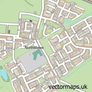
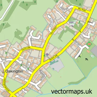
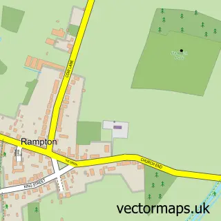
This Impington street map is a detailed vector street map covering a 750m x 750m area. Select a larger area to create and download your own vector street map of Impington.
The 750-metre map sample for Impington covers 368 mapped buildings and approximately 12.2 km of road detail, of which 24 named roads are named. The immediate area includes 1 school, 2 GP surgeries within 2 miles, 2 pubs and 4 MOT stations within 2 miles. The wider area around Impington features 1 tourism point of interest and 3 food and drink venues. To create a larger or custom map of Impington, the map builder lets you define your own coverage area and download editable SVG, PDF and PNG files.
Create a larger editable map of Impington
Choose any area you need and generate a high-quality vector map instantly. Perfect for print, planning, design, business and personal use.

This Impington street map in Cambridgeshire is available as downloadable SVG, PDF and PNG map files, or as a printed map for planning, business, display, education, local information and design work. You can also create a larger custom map area using the map selector.
What this Impington map sample shows
Impington lies within Impington Cp parish, part of Histon & Impington ward in the South Cambridgeshire District local authority area. The postcode geography for this area includes the CB postcode area, the CB24 postcode district and the CB24 9 postcode sector. Residents fall under the Nhs Cambridgeshire And Peterborough Integrated Care Board for NHS services.
Local features near Impington
Within 2 milesAmenities and services in and around Impington.
Administrative and postcode information for Impington
Impington lies within Impington Cp parish, part of Histon & Impington ward in the South Cambridgeshire District local authority area. The postcode geography for this area includes the CB postcode area, the CB24 postcode district and the CB24 9 postcode sector. Residents fall under the Nhs Cambridgeshire And Peterborough Integrated Care Board for NHS services.
Nearby street map samples around Impington

More street maps in Cambridgeshire
750 metre map area coverage
Boundary, postcode and point of interest information for the 750m x 750m rectangle centred on this sample map.
Boundaries containing map centre
Constituency: St. Neots and Mid Cambridgeshire Co Const
County: Cambridgeshire County
District: South Cambridgeshire District
Icb: NHS Central East ICB
Parish: Impington CP
Police Force: cambridgeshire
Postcode District: CB24
Postcode Sector: CB24 9
Ward: Histon & Impington Ward
Nearby boundaries intersecting sample
Parish: Histon CP
Postcode coverage
POI category counts
Auto Electrical Repair: 3
Church Cathedral: 2
Flowers And Gifts Shop: 2
Gym: 2
Pub: 2
Retirement Home: 2
Advertising Agency: 1
Auto Upholstery: 1
Beauty Salon: 1
Business To Business: 1
Sample points of interest
- Steve Fitt Illustrations & Graphics
- Clarus Systems Ltd.
- Marks Electrical Services
- Thomas Plumbing & Heating
- Times Past Interiors
- Iconic Cambridge
- 1v Facilities Ltd.
- St Andrew's Church
- The Salvation Army
- The Geographer
- Ian Sharpe Construction
- Wagz Dog Walking
Create a larger editable map of Impington
This sample shows only a 750 metre area. To create a larger map of Impington, use our map builder to choose your own coverage area, add titles and download editable SVG, PDF and PNG files.
Create a custom map of Impington