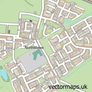
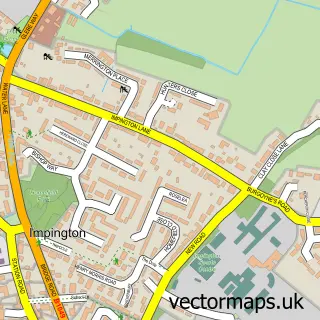
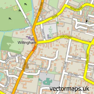
This Cottenham street map is a detailed vector street map covering a 750m x 750m area. Select a larger area to create and download your own vector street map of Cottenham.
The 750-metre map sample for Cottenham covers 741 mapped buildings and approximately 17.5 km of road detail, of which 34 named roads are named. The immediate area includes 2 pubs and 4 MOT stations within 2 miles. The wider area around Cottenham features 1 tourism point of interest, 2 food and drink venues and 1 campsite within 2 miles. To create a larger or custom map of Cottenham, the map builder lets you define your own coverage area and download editable SVG, PDF and PNG files.
Create a larger editable map of Cottenham
Choose any area you need and generate a high-quality vector map instantly. Perfect for print, planning, design, business and personal use.

This Cottenham street map in Cambridgeshire is available as downloadable SVG, PDF and PNG map files, or as a printed map for planning, business, display, education, local information and design work. You can also create a larger custom map area using the map selector.
What this Cottenham map sample shows
Cottenham lies within Cottenham Cp parish, part of Cottenham ward in the South Cambridgeshire District local authority area. The postcode geography for this area includes the CB postcode area, the CB24 postcode district and the CB24 8 postcode sector. Residents fall under the Nhs Cambridgeshire And Peterborough Integrated Care Board for NHS services.
Local features near Cottenham
Within 2 milesAmenities and services in and around Cottenham.
Administrative and postcode information for Cottenham
Cottenham lies within Cottenham Cp parish, part of Cottenham ward in the South Cambridgeshire District local authority area. The postcode geography for this area includes the CB postcode area, the CB24 postcode district and the CB24 8 postcode sector. Residents fall under the Nhs Cambridgeshire And Peterborough Integrated Care Board for NHS services.
Nearby street map samples around Cottenham

More street maps in Cambridgeshire
750 metre map area coverage
Boundary, postcode and point of interest information for the 750m x 750m rectangle centred on this sample map.
Boundaries containing map centre
Constituency: Ely and East Cambridgeshire Co Const
County: Cambridgeshire County
District: South Cambridgeshire District
Icb: NHS Central East ICB
Parish: Cottenham CP
Police Force: cambridgeshire
Postcode District: CB24
Postcode Sector: CB24 8
Ward: Cottenham Ward
Nearby boundaries intersecting sample
No additional intersecting boundaries found.
Postcode coverage
POI category counts
Professional Services: 5
Beauty Salon: 4
Bakery: 3
Contractor: 3
Dentist: 3
Doctor: 3
Advertising Agency: 2
Bank Credit Union: 2
Business Management Services: 2
Church Cathedral: 2
Sample points of interest
- The MHH Partnership
- DC Functional Fitness
- David Winch
- Method Creative
- Renegades Rugby Club
- Cambridge Audio Visual Services
- Tibbett Architectural Services
- Frameworks Cottenham
- Curry Palace
- Caretech Community Services
- The Cooperative Food (BF) Cottenham, Cottenham
- Polarglaze Ltd.
Create a larger editable map of Cottenham
This sample shows only a 750 metre area. To create a larger map of Cottenham, use our map builder to choose your own coverage area, add titles and download editable SVG, PDF and PNG files.
Create a custom map of Cottenham