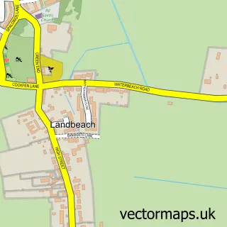
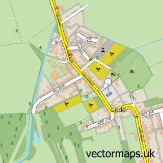
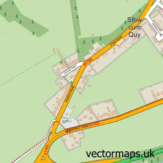
This Waterbeach street map is a detailed vector street map covering a 750m x 750m area. Select a larger area to create and download your own vector street map of Waterbeach.
The 750-metre map sample for Waterbeach covers 472 mapped buildings and approximately 14.7 km of road detail, of which 35 named roads are named. The immediate area includes 1 GP surgery within 2 miles, 3 pubs and 1 MOT station, with 4 within 2 miles. The wider area around Waterbeach features 2 tourism points of interest, 4 food and drink venues and 2 hotels. To create a larger or custom map of Waterbeach, the map builder lets you define your own coverage area and download editable SVG, PDF and PNG files.
Create a larger editable map of Waterbeach
Choose any area you need and generate a high-quality vector map instantly. Perfect for print, planning, design, business and personal use.

This Waterbeach street map in Cambridgeshire is available as downloadable SVG, PDF and PNG map files, or as a printed map for planning, business, display, education, local information and design work. You can also create a larger custom map area using the map selector.
What this Waterbeach map sample shows
Waterbeach lies within Waterbeach Cp parish, part of Milton & Waterbeach ward in the South Cambridgeshire District local authority area. The postcode geography for this area includes the CB postcode area, the CB25 postcode district and the CB25 9 postcode sector. Residents fall under the Nhs Cambridgeshire And Peterborough Integrated Care Board for NHS services.
Local features near Waterbeach
Within 2 milesAmenities and services in and around Waterbeach.
Administrative and postcode information for Waterbeach
Waterbeach lies within Waterbeach Cp parish, part of Milton & Waterbeach ward in the South Cambridgeshire District local authority area. The postcode geography for this area includes the CB postcode area, the CB25 postcode district and the CB25 9 postcode sector. Residents fall under the Nhs Cambridgeshire And Peterborough Integrated Care Board for NHS services.
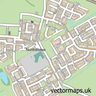
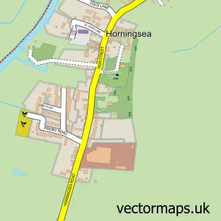
Nearby street map samples around Waterbeach

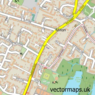
More street maps in Cambridgeshire
750 metre map area coverage
Boundary, postcode and point of interest information for the 750m x 750m rectangle centred on this sample map.
Boundaries containing map centre
Constituency: Ely and East Cambridgeshire Co Const
County: Cambridgeshire County
District: South Cambridgeshire District
Icb: NHS Central East ICB
Parish: Waterbeach CP
Police Force: cambridgeshire
Postcode District: CB25
Postcode Sector: CB25 9
Ward: Milton & Waterbeach Ward
Nearby boundaries intersecting sample
No additional intersecting boundaries found.
Postcode coverage
POI category counts
Convenience Store: 3
Pub: 3
Shipping Center: 3
Bakery: 2
Beauty Salon: 2
Building Supply Store: 2
Church Cathedral: 2
Counseling And Mental Health: 2
Hotel: 2
Pharmacy: 2
Sample points of interest
- St John the Evangelist
- Stuart Darling
- Waterbeach Recreation Ground
- Gilzean Electronics
- Boswell & Son
- Waterbeach Boswell and son
- Waterbeach Baptist Church
- JB's Hair Salon Waterbeach
- Omega Clean
- The Old School House Rooms
- Cullian Ltd
- The Van Man
Create a larger editable map of Waterbeach
This sample shows only a 750 metre area. To create a larger map of Waterbeach, use our map builder to choose your own coverage area, add titles and download editable SVG, PDF and PNG files.
Create a custom map of Waterbeach