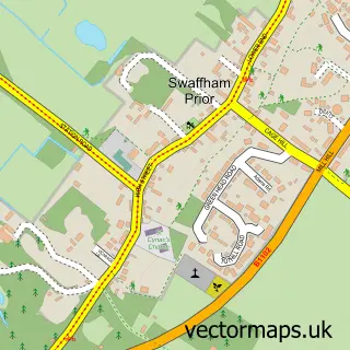
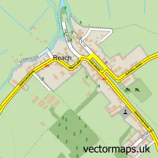
This Lode street map is a detailed vector street map covering a 750m x 750m area. Select a larger area to create and download your own vector street map of Lode.
The 750-metre map sample for Lode covers 187 mapped buildings and approximately 5.0 km of road detail, of which 12 named roads are named. The immediate area includes 1 GP surgery within 2 miles, 1 pub and 2 MOT stations within 2 miles. The wider area around Lode features 1 food and drink venue. To create a larger or custom map of Lode, the map builder lets you define your own coverage area and download editable SVG, PDF and PNG files.
Create a larger editable map of Lode
Choose any area you need and generate a high-quality vector map instantly. Perfect for print, planning, design, business and personal use.

This Lode street map in Cambridgeshire is available as downloadable SVG, PDF and PNG map files, or as a printed map for planning, business, display, education, local information and design work. You can also create a larger custom map area using the map selector.
What this Lode map sample shows
Lode lies within Lode Cp parish, part of Bottisham ward in the East Cambridgeshire District local authority area. The postcode geography for this area includes the CB postcode area, the CB25 postcode district and the CB25 9 postcode sector. Residents fall under the Nhs Cambridgeshire And Peterborough Integrated Care Board for NHS services.
Local features near Lode
Within 2 milesAmenities and services in and around Lode.
Administrative and postcode information for Lode
The local authority covering Lode is East Cambridgeshire District, within the county of Cambridgeshire. The settlement lies within Bottisham ward and Lode Cp civil parish. The CB25 postcode district and CB25 9 postcode sector serve the immediate area. NHS provision in the area is delivered through Cambridge University Hospitals Nhs Foundation Trust.
Nearby street map samples around Lode

More street maps in Cambridgeshire
750 metre map area coverage
Boundary, postcode and point of interest information for the 750m x 750m rectangle centred on this sample map.
Boundaries containing map centre
Constituency: Ely and East Cambridgeshire Co Const
County: Cambridgeshire County
District: East Cambridgeshire District
Icb: NHS Central East ICB
Parish: Lode CP
Police Force: cambridgeshire
Postcode District: CB25
Postcode Sector: CB25 9
Ward: Bottisham Ward
Nearby boundaries intersecting sample
No additional intersecting boundaries found.
Postcode coverage
POI category counts
Dog Walkers: 2
Anglican Church: 1
Appliance Store: 1
Business Consulting: 1
Church Cathedral: 1
Contractor: 1
Convenience Store: 1
Currency Exchange: 1
Elementary School: 1
Farm: 1
Sample points of interest
- Lode: St James
- Cambridge It Solutions
- Alan Lamb Associates
- Lode Chapel
- Vine Refurbishments
- The Shop at Lode
- Post Office Travel Money
- Happy Tails dog walking services
- The Countryside Dog Walker
- Little Legs of Lode
- Lode Mill
- Colourfence Cambridge
Create a larger editable map of Lode
This sample shows only a 750 metre area. To create a larger map of Lode, use our map builder to choose your own coverage area, add titles and download editable SVG, PDF and PNG files.
Create a custom map of Lode