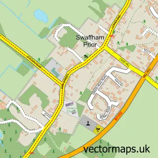
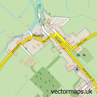
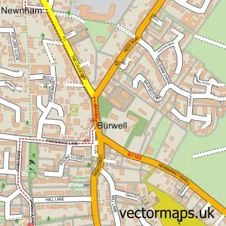
This Swaffham Bulbeck street map is a detailed vector street map covering a 750m x 750m area. Select a larger area to create and download your own vector street map of Swaffham Bulbeck.
The 750-metre map sample for Swaffham Bulbeck covers 185 mapped buildings and approximately 12.0 km of road detail, of which 10 named roads are named. The immediate area includes 1 school, 1 GP surgery within 2 miles, 2 pubs and 2 MOT stations within 2 miles. The wider area around Swaffham Bulbeck features 2 food and drink venues. To create a larger or custom map of Swaffham Bulbeck, the map builder lets you define your own coverage area and download editable SVG, PDF and PNG files.
Create a larger editable map of Swaffham Bulbeck
Choose any area you need and generate a high-quality vector map instantly. Perfect for print, planning, design, business and personal use.

This Swaffham Bulbeck street map in Cambridgeshire is available as downloadable SVG, PDF and PNG map files, or as a printed map for planning, business, display, education, local information and design work. You can also create a larger custom map area using the map selector.
What this Swaffham Bulbeck map sample shows
Swaffham Bulbeck lies within Swaffham Bulbeck Cp parish, part of Bottisham ward in the East Cambridgeshire District local authority area. The postcode geography for this area includes the CB postcode area, the CB25 postcode district and the CB25 0 postcode sector. Residents fall under the Nhs Cambridgeshire And Peterborough Integrated Care Board for NHS services.
Local features near Swaffham Bulbeck
Within 2 milesAmenities and services in and around Swaffham Bulbeck.
Administrative and postcode information for Swaffham Bulbeck
Swaffham Bulbeck lies within Swaffham Bulbeck Cp parish, part of Bottisham ward in the East Cambridgeshire District local authority area. The postcode geography for this area includes the CB postcode area, the CB25 postcode district and the CB25 0 postcode sector. Residents fall under the Nhs Cambridgeshire And Peterborough Integrated Care Board for NHS services.
Nearby street map samples around Swaffham Bulbeck

More street maps in Cambridgeshire
750 metre map area coverage
Boundary, postcode and point of interest information for the 750m x 750m rectangle centred on this sample map.
Boundaries containing map centre
Constituency: Ely and East Cambridgeshire Co Const
County: Cambridgeshire County
District: East Cambridgeshire District
Icb: NHS Central East ICB
Parish: Swaffham Bulbeck CP
Police Force: cambridgeshire
Postcode District: CB25
Postcode Sector: CB25 0
Ward: Bottisham Ward
Nearby boundaries intersecting sample
No additional intersecting boundaries found.
Postcode coverage
POI category counts
Information Technology Company: 3
Post Office: 3
Convenience Store: 2
Pub: 2
Anglican Church: 1
Charity Organization: 1
Contractor: 1
Education: 1
Elementary School: 1
Environmental Conservation And Ecological Organizations: 1
Sample points of interest
- Swaffham Bulbeck: St Mary
- Red 2 Green
- Stepney Insulation Ltd
- Nisa Local
- The Country Store
- Cambridge Forest Schools
- Swaffham Bulbeck C of E Primary School
- Alliance Asbestos Services
- Lipotrim
- Backup Data
- Backup Data Ltd.
- GsdIT
Create a larger editable map of Swaffham Bulbeck
This sample shows only a 750 metre area. To create a larger map of Swaffham Bulbeck, use our map builder to choose your own coverage area, add titles and download editable SVG, PDF and PNG files.
Create a custom map of Swaffham Bulbeck