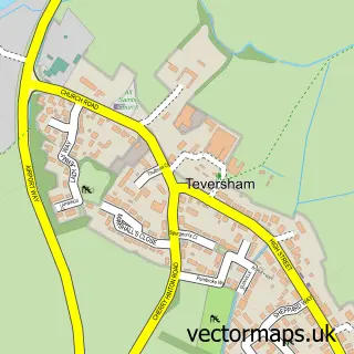
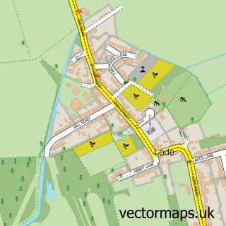
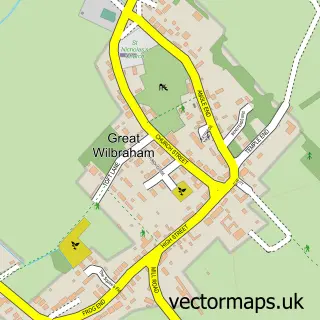
This Stow-cum-Quy street map is a detailed vector street map covering a 750m x 750m area. Select a larger area to create and download your own vector street map of Stow-cum-Quy.
The 750-metre map sample for Stow-cum-Quy covers 114 mapped buildings and approximately 11.1 km of road detail, of which 7 named roads are named. The immediate area includes 1 GP surgery within 2 miles and 4 MOT stations within 2 miles. The wider area around Stow-cum-Quy features 1 tourism point of interest. To create a larger or custom map of Stow-cum-Quy, the map builder lets you define your own coverage area and download editable SVG, PDF and PNG files.
Create a larger editable map of Stow-cum-Quy
Choose any area you need and generate a high-quality vector map instantly. Perfect for print, planning, design, business and personal use.

This Stow-cum-Quy street map in Cambridgeshire is available as downloadable SVG, PDF and PNG map files, or as a printed map for planning, business, display, education, local information and design work. You can also create a larger custom map area using the map selector.
What this Stow-cum-Quy map sample shows
Stow-cum-Quy lies within Stow Cum Quy Cp parish, part of Fen Ditton & Fulbourn ward in the South Cambridgeshire District local authority area. The postcode geography for this area includes the CB postcode area, the CB25 postcode district and the CB25 9 postcode sector. Residents fall under the Nhs Cambridgeshire And Peterborough Integrated Care Board for NHS services.
Local features near Stow-cum-Quy
Within 2 milesAmenities and services in and around Stow-cum-Quy.
Administrative and postcode information for Stow-cum-Quy
The local authority covering Stow-cum-Quy is South Cambridgeshire District, within the county of Cambridgeshire. The settlement lies within Fen Ditton & Fulbourn ward and Stow Cum Quy Cp civil parish. The CB25 postcode district and CB25 9 postcode sector serve the immediate area. NHS provision in the area is delivered through Cambridge University Hospitals Nhs Foundation Trust.
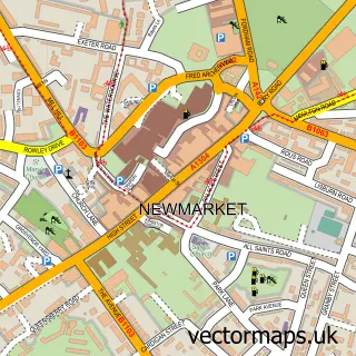
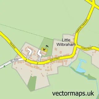
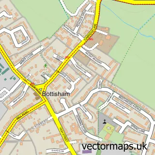
Nearby street map samples around Stow-cum-Quy

More street maps in Cambridgeshire
750 metre map area coverage
Boundary, postcode and point of interest information for the 750m x 750m rectangle centred on this sample map.
Boundaries containing map centre
Constituency: South Cambridgeshire Co Const
County: Cambridgeshire County
District: South Cambridgeshire District
Icb: NHS Central East ICB
Parish: Stow cum Quy CP
Police Force: cambridgeshire
Postcode District: CB25
Postcode Sector: CB25 9
Ward: Fen Ditton & Fulbourn Ward
Nearby boundaries intersecting sample
Parish: Little Wilbraham CP
Postcode District: CB21
Postcode Sector: CB21 5
Postcode coverage
POI category counts
Advertising Agency: 1
Anglican Church: 1
Attractions And Activities: 1
Building Contractor: 1
Day Spa: 1
Financial Service: 1
Printing Services: 1
Swimming Pool: 1
Telecommunications Company: 1
Sample points of interest
- Footprint Signs and Graphics
- Quy: St Mary
- Ancient Oak Fayre
- Gaskin Bros General Building
- Quy Mill Hotel & Spa
- Coinepay虚拟U卡visa万事达
- Footprint Signs & Graphics Ltd
- Elite Swimming Academy
- IoTAS
Create a larger editable map of Stow-cum-Quy
This sample shows only a 750 metre area. To create a larger map of Stow-cum-Quy, use our map builder to choose your own coverage area, add titles and download editable SVG, PDF and PNG files.
Create a custom map of Stow-cum-Quy