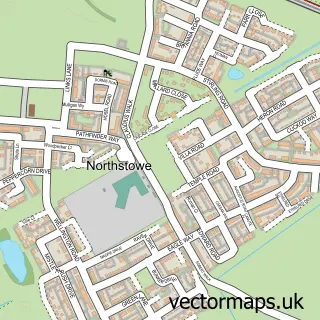
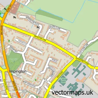
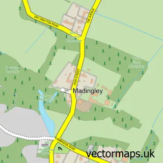
This Oakington street map is a detailed vector street map covering a 750m x 750m area. Select a larger area to create and download your own vector street map of Oakington.
The 750-metre map sample for Oakington covers 298 mapped buildings and approximately 11.4 km of road detail, of which 22 named roads are named. The immediate area includes 1 school, 1 pub and 1 MOT station, with 3 within 2 miles. The wider area around Oakington features 1 tourism point of interest and 2 food and drink venues. To create a larger or custom map of Oakington, the map builder lets you define your own coverage area and download editable SVG, PDF and PNG files.
Create a larger editable map of Oakington
Choose any area you need and generate a high-quality vector map instantly. Perfect for print, planning, design, business and personal use.

This Oakington street map in Cambridgeshire is available as downloadable SVG, PDF and PNG map files, or as a printed map for planning, business, display, education, local information and design work. You can also create a larger custom map area using the map selector.
What this Oakington map sample shows
Oakington lies within Oakington And Westwick Cp parish, part of Longstanton ward in the South Cambridgeshire District local authority area. The postcode geography for this area includes the CB postcode area, the CB24 postcode district and the CB24 3 postcode sector. Residents fall under the Nhs Cambridgeshire And Peterborough Integrated Care Board for NHS services.
Local features near Oakington
Within 2 milesAmenities and services in and around Oakington.
Administrative and postcode information for Oakington
The local authority covering Oakington is South Cambridgeshire District, within the county of Cambridgeshire. The settlement lies within Longstanton ward and Oakington And Westwick Cp civil parish. The CB24 postcode district and CB24 3 postcode sector serve the immediate area. NHS provision in the area is delivered through Cambridge University Hospitals Nhs Foundation Trust.
Nearby street map samples around Oakington

More street maps in Cambridgeshire
750 metre map area coverage
Boundary, postcode and point of interest information for the 750m x 750m rectangle centred on this sample map.
Boundaries containing map centre
Constituency: St. Neots and Mid Cambridgeshire Co Const
County: Cambridgeshire County
District: South Cambridgeshire District
Icb: NHS Central East ICB
Parish: Oakington and Westwick CP
Police Force: cambridgeshire
Postcode District: CB24
Postcode Sector: CB24 3
Ward: Longstanton Ward
Nearby boundaries intersecting sample
Parish: Northstowe CP
Postcode coverage
POI category counts
Web Designer: 3
Active Life: 1
Adult Education: 1
Anglican Church: 1
Automotive Repair: 1
Beauty Salon: 1
Building Supply Store: 1
Coffee Shop: 1
Convenience Store: 1
Cosmetic And Beauty Supplies: 1
Sample points of interest
- Oakington Pavillion
- Cambridge Guardian Angels
- St Andrew
- Optimus Commercials & Engineering
- Beauty Binge
- BM Build
- Crossways
- Nisa Local
- Beauty to you
- Post Office Travel Money
- Drive Teulon
- Blue Barrel Cider
Create a larger editable map of Oakington
This sample shows only a 750 metre area. To create a larger map of Oakington, use our map builder to choose your own coverage area, add titles and download editable SVG, PDF and PNG files.
Create a custom map of Oakington