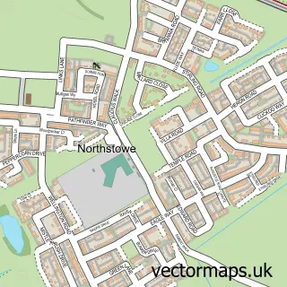
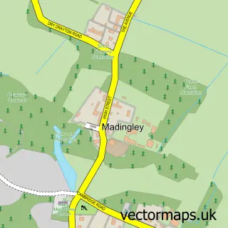
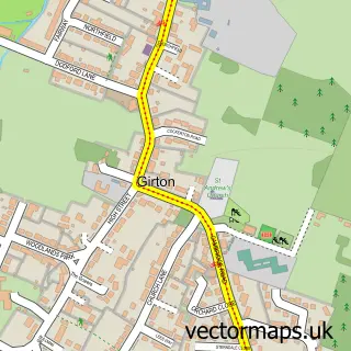
This Bar Hill street map is a detailed vector street map covering a 750m x 750m area. Select a larger area to create and download your own vector street map of Bar Hill.
The 750-metre map sample for Bar Hill covers 312 mapped buildings and approximately 15.8 km of road detail, of which 18 named roads are named. The immediate area includes 1 school, 1 GP surgery, 1 pub and 1 MOT station, with 3 within 2 miles. The wider area around Bar Hill features 6 food and drink venues. To create a larger or custom map of Bar Hill, the map builder lets you define your own coverage area and download editable SVG, PDF and PNG files.
Create a larger editable map of Bar Hill
Choose any area you need and generate a high-quality vector map instantly. Perfect for print, planning, design, business and personal use.

This Bar Hill street map in Cambridgeshire is available as downloadable SVG, PDF and PNG map files, or as a printed map for planning, business, display, education, local information and design work. You can also create a larger custom map area using the map selector.
What this Bar Hill map sample shows
Bar Hill lies within Bar Hill Cp parish, part of Bar Hill ward in the South Cambridgeshire District local authority area. The postcode geography for this area includes the CB postcode area, the CB23 postcode district and the CB23 8 postcode sector. Residents fall under the Nhs Cambridgeshire And Peterborough Integrated Care Board for NHS services.
Local features near Bar Hill
Within 2 milesAmenities and services in and around Bar Hill.
Administrative and postcode information for Bar Hill
The local authority covering Bar Hill is South Cambridgeshire District, within the county of Cambridgeshire. The settlement lies within Bar Hill ward and Bar Hill Cp civil parish. The CB23 postcode district and CB23 8 postcode sector serve the immediate area. NHS provision in the area is delivered through Cambridge University Hospitals Nhs Foundation Trust.
Nearby street map samples around Bar Hill

More street maps in Cambridgeshire
750 metre map area coverage
Boundary, postcode and point of interest information for the 750m x 750m rectangle centred on this sample map.
Boundaries containing map centre
Constituency: St. Neots and Mid Cambridgeshire Co Const
County: Cambridgeshire County
District: South Cambridgeshire District
Icb: NHS Central East ICB
Parish: Bar Hill CP
Police Force: cambridgeshire
Postcode District: CB23
Postcode Sector: CB23 8
Ward: Bar Hill Ward
Nearby boundaries intersecting sample
Parish: Lolworth CP
Ward: Swavesey Ward
Postcode coverage
POI category counts
Beauty Salon: 4
Car Wash: 4
Photography Store And Services: 4
Barber: 3
Retail: 3
Automotive Repair: 2
Bank Credit Union: 2
Cafe: 2
Clothing Store: 2
Coffee Shop: 2
Sample points of interest
- Trans.Form
- Bar Hill Motors
- Blackcircles.com Pit Stop, Cambridge
- Tesco Bank
- Tesco Travel Money
- Ashleys Barber Shop
- Gould Barbers
- Gould Barbers Cambridge (Bar Hill)
- Alice's Wonderland Beauty Boutique
- K&E Pro Aesthetics Ltd Bar Hill
- Pretty Please Beauty
- Total Relaxation
Create a larger editable map of Bar Hill
This sample shows only a 750 metre area. To create a larger map of Bar Hill, use our map builder to choose your own coverage area, add titles and download editable SVG, PDF and PNG files.
Create a custom map of Bar Hill