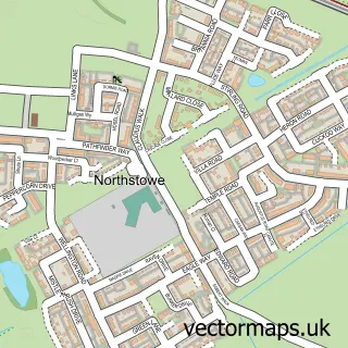
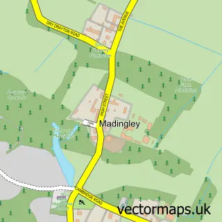
This Girton street map is a detailed vector street map covering a 750m x 750m area. Select a larger area to create and download your own vector street map of Girton.
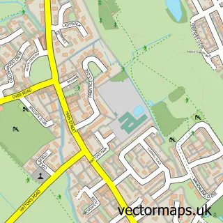
The 750-metre map sample for Girton covers 333 mapped buildings and approximately 10.6 km of road detail, of which 20 named roads are named. The immediate area includes 1 school, 1 GP surgery within 2 miles, 3 pubs and 6 MOT stations within 2 miles. The wider area around Girton features 1 tourism point of interest and 3 food and drink venues. To create a larger or custom map of Girton, the map builder lets you define your own coverage area and download editable SVG, PDF and PNG files.
Create a larger editable map of Girton
Choose any area you need and generate a high-quality vector map instantly. Perfect for print, planning, design, business and personal use.

This Girton street map in Cambridgeshire is available as downloadable SVG, PDF and PNG map files, or as a printed map for planning, business, display, education, local information and design work. You can also create a larger custom map area using the map selector.
What this Girton map sample shows
Girton lies within Girton Cp parish, part of Girton ward in the South Cambridgeshire District local authority area. The postcode geography for this area includes the CB postcode area, the CB3 postcode district and the CB3 0 postcode sector. Residents fall under the Nhs Cambridgeshire And Peterborough Integrated Care Board for NHS services.
Local features near Girton
Within 2 milesAmenities and services in and around Girton.
Administrative and postcode information for Girton
Girton lies within Girton Cp parish, part of Girton ward in the South Cambridgeshire District local authority area. The postcode geography for this area includes the CB postcode area, the CB3 postcode district and the CB3 0 postcode sector. Residents fall under the Nhs Cambridgeshire And Peterborough Integrated Care Board for NHS services.
Nearby street map samples around Girton

More street maps in Cambridgeshire
750 metre map area coverage
Boundary, postcode and point of interest information for the 750m x 750m rectangle centred on this sample map.
Boundaries containing map centre
Constituency: St. Neots and Mid Cambridgeshire Co Const
County: Cambridgeshire County
District: South Cambridgeshire District
Icb: NHS Central East ICB
Parish: Girton CP
Police Force: cambridgeshire
Postcode District: CB3
Postcode Sector: CB3 0
Ward: Girton Ward
Nearby boundaries intersecting sample
No additional intersecting boundaries found.
Postcode coverage
POI category counts
Church Cathedral: 3
Gym: 3
Pub: 3
Home Service: 2
It Service And Computer Repair: 2
Preschool: 2
Telecommunications: 2
Amusement Park: 1
Assisted Living Facility: 1
Automotive Services And Repair: 1
Sample points of interest
- Beefeater
- Gretton Court
- Mortella I.T Services
- Girton Baptist Church
- Wayfinding Consultants
- Girton Town Charity
- Messy Church Girton
- Saint Andrews Church Girton
- St Andrew's Girton
- Cotton Hall
- Girton Pavilion
- Datamation
Create a larger editable map of Girton
This sample shows only a 750 metre area. To create a larger map of Girton, use our map builder to choose your own coverage area, add titles and download editable SVG, PDF and PNG files.
Create a custom map of Girton