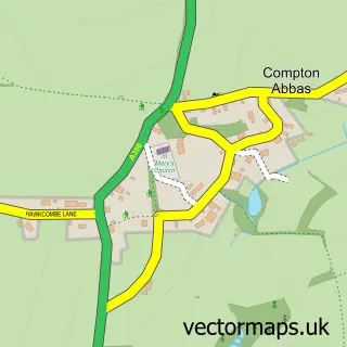
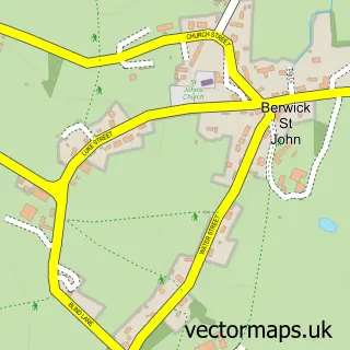
This Ashmore street map is a detailed vector street map covering a 750m x 750m area. Select a larger area to create and download your own vector street map of Ashmore.
The 750-metre map sample for Ashmore covers 100 mapped buildings and approximately 12.3 km of road detail, of which 5 named roads are named. The immediate area includes 1 MOT station. To create a larger or custom map of Ashmore, the map builder lets you define your own coverage area and download editable SVG, PDF and PNG files.
Create a larger editable map of Ashmore
Choose any area you need and generate a high-quality vector map instantly. Perfect for print, planning, design, business and personal use.

This Ashmore street map in Dorset is available as downloadable SVG, PDF and PNG map files, or as a printed map for planning, business, display, education, local information and design work. You can also create a larger custom map area using the map selector.
What this Ashmore map sample shows
Ashmore lies within Ashmore Cp parish, part of Beacon ward in the Dorset local authority area. The postcode geography for this area includes the SP postcode area, the SP5 postcode district and the SP5 5 postcode sector. Residents fall under the Nhs Dorset Integrated Care Board for NHS services.
Local features near Ashmore
Within 2 milesAmenities and services in and around Ashmore.
Administrative and postcode information for Ashmore
The local authority covering Ashmore is Dorset, within the county of Dorset. The settlement lies within Beacon ward and Ashmore Cp civil parish. The SP5 postcode district and SP5 5 postcode sector serve the immediate area. NHS provision in the area is delivered through Dorset County Hospital Nhs Foundation Trust.
Nearby street map samples around Ashmore

More street maps in Dorset
750 metre map area coverage
Boundary, postcode and point of interest information for the 750m x 750m rectangle centred on this sample map.
Boundaries containing map centre
Constituency: North Dorset Co Const
District: Dorset
Icb: NHS Dorset ICB
Parish: Ashmore CP
Police Force: dorset
Postcode District: SP5
Postcode Sector: SP5 5
Ward: Beacon Ward
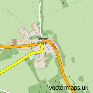
Nearby boundaries intersecting sample
Constituency: Salisbury Co Const
District: Wiltshire
Icb: NHS Bath and North East Somerset Swindon and Wiltshire ICB
Parish: Tollard Royal CP
Police Force: wiltshire
Postcode coverage
POI category counts
Anglican Church: 1
Art Gallery: 1
Automotive Repair: 1
Bed And Breakfast: 1
Doctor: 1
Fire Protection Service: 1
Hypnosis Hypnotherapy: 1
Sample points of interest
- Ashmore: St Nicholas
- Blandford Arts Hub
- Moto Corsa
- Glebe Farm Ashmore
- معمل رعاية لللتحاليل الطبيه
- Wessex Fire and Rescue Service
- Becky Booth
Create a larger editable map of Ashmore
This sample shows only a 750 metre area. To create a larger map of Ashmore, use our map builder to choose your own coverage area, add titles and download editable SVG, PDF and PNG files.
Create a custom map of Ashmore