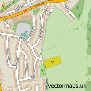
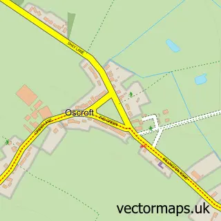
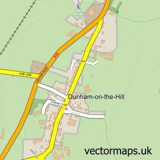
This Ashton Hayes street map is a detailed vector street map covering a 750m x 750m area. Select a larger area to create and download your own vector street map of Ashton Hayes.
The 750-metre map sample for Ashton Hayes covers 268 mapped buildings and approximately 10.3 km of road detail, of which 19 named roads are named. The immediate area includes 1 school, 1 GP surgery within 2 miles and 2 MOT stations within 2 miles. The wider area around Ashton Hayes features 1 hotel. To create a larger or custom map of Ashton Hayes, the map builder lets you define your own coverage area and download editable SVG, PDF and PNG files.
Create a larger editable map of Ashton Hayes
Choose any area you need and generate a high-quality vector map instantly. Perfect for print, planning, design, business and personal use.

This Ashton Hayes street map in Cheshire is available as downloadable SVG, PDF and PNG map files, or as a printed map for planning, business, display, education, local information and design work. You can also create a larger custom map area using the map selector.
What this Ashton Hayes map sample shows
Ashton Hayes lies within Ashton Hayes And Horton-Cum-Peel Cp parish, part of Sandstone ward in the Cheshire West And Chester (B) local authority area. The postcode geography for this area includes the CH postcode area, the CH3 postcode district and the CH3 8 postcode sector. Residents fall under the Nhs Cheshire And Merseyside Integrated Care Board for NHS services.
Local features near Ashton Hayes
Within 2 milesAmenities and services in and around Ashton Hayes.
Administrative and postcode information for Ashton Hayes
Ashton Hayes lies within Ashton Hayes And Horton-Cum-Peel Cp parish, part of Sandstone ward in the Cheshire West And Chester (B) local authority area. The postcode geography for this area includes the CH postcode area, the CH3 postcode district and the CH3 8 postcode sector. Residents fall under the Nhs Cheshire And Merseyside Integrated Care Board for NHS services.
Nearby street map samples around Ashton Hayes

More street maps in Cheshire
750 metre map area coverage
Boundary, postcode and point of interest information for the 750m x 750m rectangle centred on this sample map.
Boundaries containing map centre
Constituency: Runcorn and Helsby Co Const
District: Cheshire West and Chester (B)
Icb: NHS Cheshire and Merseyside ICB
Parish: Ashton Hayes and Horton-cum-Peel CP
Police Force: cheshire
Postcode District: CH3
Postcode Sector: CH3 8
Ward: Sandstone Ward
Nearby boundaries intersecting sample
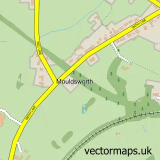
Parish: Mouldsworth CP
Postcode coverage
POI category counts
Beauty Salon: 2
Education: 2
Professional Services: 2
Bridal Shop: 1
Carpet Store: 1
Church Cathedral: 1
Community Services Non Profits: 1
Convenience Store: 1
Counseling And Mental Health: 1
Dance School: 1
Sample points of interest
- Dusk Beauty
- SXY Skin Clinic
- Home James Chauffeurs
- Abbey Marquees
- St John the Evangelist's Church
- Ash-Worth Time Bank
- Ashton Hayes & Mouldsworth Community Shop
- Chester Counselling and Psychotherapy
- Janis Anderson School of Dancing
- I See Maths
- Peel Bloodstock
- Ashton Hayes Primary School
Create a larger editable map of Ashton Hayes
This sample shows only a 750 metre area. To create a larger map of Ashton Hayes, use our map builder to choose your own coverage area, add titles and download editable SVG, PDF and PNG files.
Create a custom map of Ashton Hayes