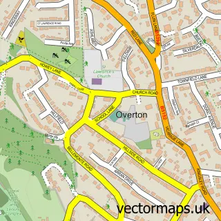
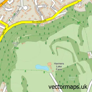
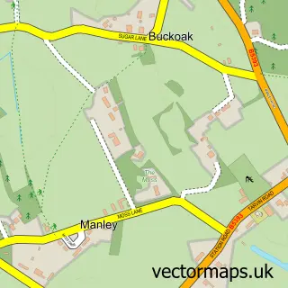
This Frodsham street map is a detailed vector street map covering a 750m x 750m area. Select a larger area to create and download your own vector street map of Frodsham.
The 750-metre map sample for Frodsham covers 325 mapped buildings and approximately 8.8 km of road detail, of which 19 named roads are named. The immediate area includes 1 school, 1 GP surgery within 2 miles and 1 MOT station, with 6 within 2 miles. The wider area around Frodsham features 1 tourism point of interest and 1 food and drink venue. To create a larger or custom map of Frodsham, the map builder lets you define your own coverage area and download editable SVG, PDF and PNG files.
Create a larger editable map of Frodsham
Choose any area you need and generate a high-quality vector map instantly. Perfect for print, planning, design, business and personal use.

This Frodsham street map in Cheshire is available as downloadable SVG, PDF and PNG map files, or as a printed map for planning, business, display, education, local information and design work. You can also create a larger custom map area using the map selector.
What this Frodsham map sample shows
Frodsham lies within Frodsham Cp parish, part of Frodsham ward in the Cheshire West And Chester (B) local authority area. The postcode geography for this area includes the WA postcode area, the WA6 postcode district and the WA6 6 postcode sector. Residents fall under the Nhs Cheshire And Merseyside Integrated Care Board for NHS services.
Local features near Frodsham
Within 2 milesAmenities and services in and around Frodsham.
Administrative and postcode information for Frodsham
The local authority covering Frodsham is Cheshire West And Chester (B), within the county of Cheshire. The settlement lies within Frodsham ward and Frodsham Cp civil parish. The WA6 postcode district and WA6 6 postcode sector serve the immediate area. NHS provision in the area is delivered through Countess Of Chester Hospital Nhs Foundation Trust.
Nearby street map samples around Frodsham

More street maps in Cheshire
750 metre map area coverage
Boundary, postcode and point of interest information for the 750m x 750m rectangle centred on this sample map.
Boundaries containing map centre
Constituency: Runcorn and Helsby Co Const
District: Cheshire West and Chester (B)
Icb: NHS Cheshire and Merseyside ICB
Parish: Frodsham CP
Police Force: cheshire
Postcode District: WA6
Postcode Sector: WA6 7
Ward: Frodsham Ward
Nearby boundaries intersecting sample
Postcode Sector: WA6 6
Postcode coverage
POI category counts
Building Supply Store: 3
Clothing Store: 3
Convenience Store: 2
Electrician: 2
Food Delivery Service: 2
Gas Station: 2
It Service And Computer Repair: 2
Marketing Consultant: 2
Topic Publisher: 2
Advertising Agency: 1
Sample points of interest
- Igoe Group
- PB Audio and styling
- Touchpoint Media
- Fenns Bank
- Cheshire BikeFix
- The Large Print Bookshop
- Chris Peate Gardens
- Earthborn Paints
- Perfect Floors and Interiors
- Hurst Joinery Ltd
- Perfect Floors and Interiors
- Chef in my Kitchen
Create a larger editable map of Frodsham
This sample shows only a 750 metre area. To create a larger map of Frodsham, use our map builder to choose your own coverage area, add titles and download editable SVG, PDF and PNG files.
Create a custom map of Frodsham