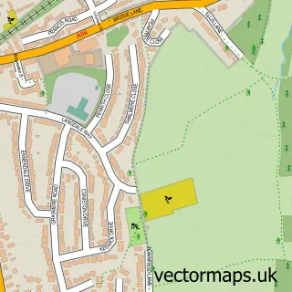
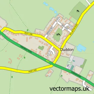
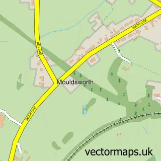
This Tarvin street map is a detailed vector street map covering a 750m x 750m area. Select a larger area to create and download your own vector street map of Tarvin.
The 750-metre map sample for Tarvin covers 297 mapped buildings and approximately 9.8 km of road detail, of which 21 named roads are named. The immediate area includes 1 GP surgery within 2 miles, 3 pubs and 1 MOT station. The wider area around Tarvin features 1 tourism point of interest and 9 food and drink venues. To create a larger or custom map of Tarvin, the map builder lets you define your own coverage area and download editable SVG, PDF and PNG files.
Create a larger editable map of Tarvin
Choose any area you need and generate a high-quality vector map instantly. Perfect for print, planning, design, business and personal use.

This Tarvin street map in Cheshire is available as downloadable SVG, PDF and PNG map files, or as a printed map for planning, business, display, education, local information and design work. You can also create a larger custom map area using the map selector.
What this Tarvin map sample shows
Tarvin lies within Tarvin Cp parish, part of Tarvin & Kelsall ward in the Cheshire West And Chester (B) local authority area. The postcode geography for this area includes the CH postcode area, the CH3 postcode district and the CH3 8 postcode sector. Residents fall under the Nhs Cheshire And Merseyside Integrated Care Board for NHS services.
Local features near Tarvin
Within 2 milesAmenities and services in and around Tarvin.
Administrative and postcode information for Tarvin
Tarvin lies within Tarvin Cp parish, part of Tarvin & Kelsall ward in the Cheshire West And Chester (B) local authority area. The postcode geography for this area includes the CH postcode area, the CH3 postcode district and the CH3 8 postcode sector. Residents fall under the Nhs Cheshire And Merseyside Integrated Care Board for NHS services.
Nearby street map samples around Tarvin

More street maps in Cheshire
750 metre map area coverage
Boundary, postcode and point of interest information for the 750m x 750m rectangle centred on this sample map.
Boundaries containing map centre
Constituency: Chester South and Eddisbury Co Const
District: Cheshire West and Chester (B)
Icb: NHS Cheshire and Merseyside ICB
Parish: Tarvin CP
Police Force: cheshire
Postcode District: CH3
Postcode Sector: CH3 8
Ward: Tarvin & Kelsall Ward
Nearby boundaries intersecting sample
No additional intersecting boundaries found.
Postcode coverage
POI category counts
Beauty Salon: 4
Church Cathedral: 4
Gas Station: 4
Hair Salon: 4
Cafe: 3
Pub: 3
Barber: 2
Car Dealer: 2
Clothing Store: 2
Public And Government Association: 2
Sample points of interest
- D.P.F Agriculture Services
- St Andrew
- The Treasure Trove
- The Cooperative Food (BF) Tarvin, Tarvin
- Don Barrow Rally Navigation Equipment
- Tarvin Garage Services
- Novum Salons
- Yolo barber
- Chocolate Lime
- No.73 Hair & Beauty
- Novum
- Serenity Beauty Salon
Create a larger editable map of Tarvin
This sample shows only a 750 metre area. To create a larger map of Tarvin, use our map builder to choose your own coverage area, add titles and download editable SVG, PDF and PNG files.
Create a custom map of Tarvin