Vector Maps logo
Home Why it works Popular maps Districts Samples Customizer Create Your Map
VectorMaps.uk
Home Popular maps Districts Samples Customizer Create Your Map Privacy Disclaimer
Home / UK Maps / Argyll and Bute / Baile Mòr Map

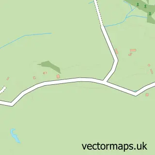
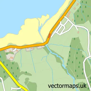
This Baile Mòr street map is a detailed vector street map covering a 750m x 750m area. Select a larger area to create and download your own vector street map of Baile Mòr.

Baile Mòr is a village in Argyll And Bute. The settlement falls within the Argyll And Bute parliamentary constituency.

The 750-metre map sample for Baile Mòr covers 35 mapped buildings and approximately 5.8 km of road detail, of which 1 named road are named. The wider area around Baile Mòr features 3 tourism points of interest, 1 food and drink venue and 2 hotels. To create a larger or custom map of Baile Mòr, the map builder lets you define your own coverage area and download editable SVG, PDF and PNG files.

35Buildings
5.83 kmRoads
1Named roads
0Residents within 2 miles
Create your own

Create a larger editable map of Baile Mòr

Choose any area you need and generate a high-quality vector map instantly. Perfect for print, planning, design, business and personal use.

Choose any location
Editable SVG files
Any size up to A0
PDF, PNG & more
Instant download
High quality guaranteed
Create My Custom Map
Secure, private & no credit card required
Baile Mòr Vector Street Map
750m Sample
Baile Mòr vector street map sample showing roads, buildings and local features in a 750 metre preview area
Buy Baile Mòr Map Print from £12.95 Buy Baile Mòr Digital Map from £6

This Baile Mòr street map in Argyll and Bute is available as downloadable SVG, PDF and PNG map files, or as a printed map for planning, business, display, education, local information and design work. You can also create a larger custom map area using the map selector.

What this Baile Mòr map sample shows

Baile Mòr is a village in Argyll And Bute, recorded in the UK street map gallery with associated local administrative and mapping data.

Local features near Baile Mòr

Within 2 miles

Amenities and services in and around Baile Mòr.

3 Tourism & leisure
1 Food & drink
2 Hotels
1 Healthcare POIs

Counts are approximate and based on publicly available data.

Administrative and postcode information for Baile Mòr

Within the county of Argyll And Bute, Baile Mòr is a village.

County Argyll and Bute
Parliamentary constituency Argyll and Bute

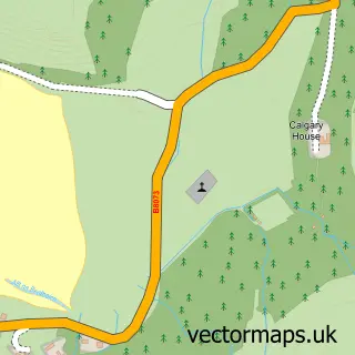
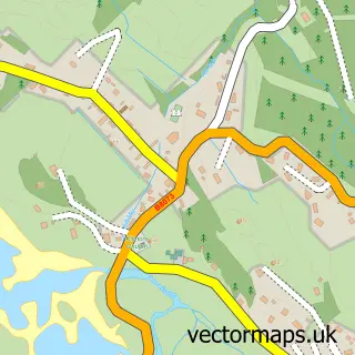
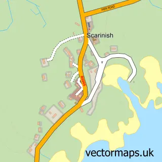
Nearby street map samples around Baile Mòr

Street map sample of Tobermory, Argyll and Bute Tobermory Town - Argyll and Bute - 23.7 miles Street map sample of Glasgow, City of Glasgow Glasgow City - City of Glasgow - 88.7 miles Street map sample of Fionnphort, Argyll and Bute Fionnphort Village - Argyll and Bute - 1.2 miles Street map sample of Bunessan, Argyll and Bute Bunessan Village - Argyll and Bute - 6.2 miles Street map sample of Ardtun, Argyll and Bute Ardtun Village - Argyll and Bute - 6.6 miles Street map sample of Pennyghael, Argyll and Bute Pennyghael Village - Argyll and Bute - 14.5 miles Street map sample of Calgary, Argyll and Bute Calgary Village - Argyll and Bute - 17.7 miles Street map sample of Dervaig, Argyll and Bute Dervaig Village - Argyll and Bute - 19.5 miles Street map sample of Sgairinis, Argyll and Bute Sgairinis Village - Argyll and Bute - 19.7 miles Street map sample of Scalasaig, Argyll and Bute Scalasaig Village - Argyll and Bute - 19.7 miles

More street maps in Argyll and Bute

Street map sample of Fionnphort, Argyll and Bute Fionnphort Village - 1.2 miles Street map sample of Bunessan, Argyll and Bute Bunessan Village - 6.2 miles Street map sample of Ardtun, Argyll and Bute Ardtun Village - 6.6 miles Street map sample of Pennyghael, Argyll and Bute Pennyghael Village - 14.5 miles Street map sample of Calgary, Argyll and Bute Calgary Village - 17.7 miles

750 metre map area coverage

Boundary, postcode and point of interest information for the 750m x 750m rectangle centred on this sample map.

Boundaries containing map centre

Constituency: Argyll, Bute and South Lochaber Co Const

District: Argyll and Bute

Icb: Highland

Postcode District: PA76

Postcode Sector: PA76 6

Ward: Oban South and the Isles Ward

Nearby boundaries intersecting sample

No additional intersecting boundaries found.

Postcode coverage

PA76 PA76 6

POI category counts

Church Cathedral: 3

Convenience Store: 2

Flowers And Gifts Shop: 2

Hotel: 2

Landmark And Historical Building: 2

Post Office: 2

Arts And Crafts: 1

Beach: 1

Bed And Breakfast: 1

Boat Tours: 1

Sample points of interest

  • Oran Creative Crafts Arts And Crafts
  • North Beach, Isle of Iona, Scotland Beach
  • Martyrs Bay Rooms Bed And Breakfast
  • Alternative Boat Hire Boat Tours
  • The Rookery Cafe Cafe
  • Iona and the Ross of Mull Catholic Church
  • Iona Abbey Church Cathedral
  • Iona Church Church Cathedral
  • St Oran's Chapel Church Cathedral
  • SPAR Convenience Store
  • SPAR Isle Of Iona Convenience Store
  • Mull and Iona Medical Group (Isle of Iona) Doctor

Create a larger editable map of Baile Mòr

This sample shows only a 750 metre area. To create a larger map of Baile Mòr, use our map builder to choose your own coverage area, add titles and download editable SVG, PDF and PNG files.

Create a custom map of Baile Mòr

Phone 01751 473136 | Copyright Vectormaps.uk 2026

Samples Customizer Privacy Disclaimer
Baile Mòr Vector Street Map
Baile Mòr enlarged street map sample showing a 750 metre preview area