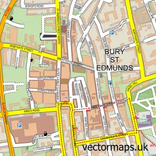
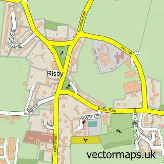
This Barrow street map is a detailed vector street map covering a 750m x 750m area. Select a larger area to create and download your own vector street map of Barrow.
The 750-metre map sample for Barrow covers 345 mapped buildings and approximately 10.3 km of road detail, of which 20 named roads are named. The immediate area includes 3 pubs and 1 MOT station, with 2 within 2 miles. The wider area around Barrow features 3 food and drink venues. To create a larger or custom map of Barrow, the map builder lets you define your own coverage area and download editable SVG, PDF and PNG files.
Create a larger editable map of Barrow
Choose any area you need and generate a high-quality vector map instantly. Perfect for print, planning, design, business and personal use.

This Barrow street map in Suffolk is available as downloadable SVG, PDF and PNG map files, or as a printed map for planning, business, display, education, local information and design work. You can also create a larger custom map area using the map selector.
What this Barrow map sample shows
Barrow lies within Barrow Cp parish, part of Barrow ward in the West Suffolk District local authority area. The postcode geography for this area includes the IP postcode area, the IP29 postcode district and the IP29 5 postcode sector. Residents fall under the Nhs Suffolk And North East Essex Integrated Care Board for NHS services.
Local features near Barrow
Within 2 milesAmenities and services in and around Barrow.
Administrative and postcode information for Barrow
The local authority covering Barrow is West Suffolk District, within the county of Suffolk. The settlement lies within Barrow ward and Barrow Cp civil parish. The IP29 postcode district and IP29 5 postcode sector serve the immediate area. NHS provision in the area is delivered through West Suffolk Nhs Foundation Trust.
Nearby street map samples around Barrow

More street maps in Suffolk
750 metre map area coverage
Boundary, postcode and point of interest information for the 750m x 750m rectangle centred on this sample map.
Boundaries containing map centre
Constituency: West Suffolk Co Const
County: Suffolk County
District: West Suffolk District
Icb: NHS Essex ICB
Parish: Barrow CP
Police Force: suffolk
Postcode District: IP29
Postcode Sector: IP29 5
Ward: Barrow Ward
Nearby boundaries intersecting sample
Parish: Denham CP
Postcode coverage
POI category counts
Convenience Store: 5
Pub: 3
Automotive Repair: 2
Bar: 2
Car Dealer: 2
Contractor: 2
Advertising Agency: 1
Antique Store: 1
Arts And Entertainment: 1
Atms: 1
Sample points of interest
- North Star Creation
- Denzil Grant Antiques and Restoration
- John Glover
- PREMIER STORES, BARROW
- Red Shift Motorcycles
- Service 2
- Roman Doric
- Greene King
- Three Horseshoes
- Classic Prestige Cars
- Prestige New and Used Car Sales
- Barrow Village Hall
Create a larger editable map of Barrow
This sample shows only a 750 metre area. To create a larger map of Barrow, use our map builder to choose your own coverage area, add titles and download editable SVG, PDF and PNG files.
Create a custom map of Barrow