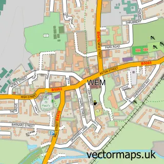
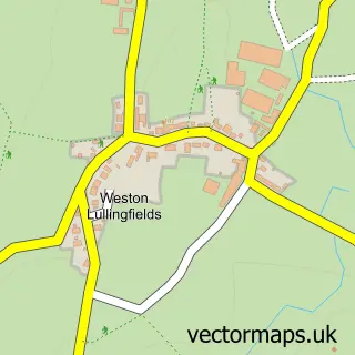
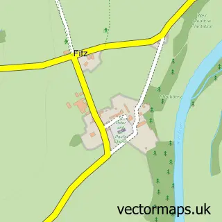
This Baschurch street map is a detailed vector street map covering a 750m x 750m area. Select a larger area to create and download your own vector street map of Baschurch.
The 750-metre map sample for Baschurch covers 441 mapped buildings and approximately 18.2 km of road detail, of which 27 named roads are named. The immediate area includes 1 primary school and 1 secondary school, 1 GP surgery within 2 miles, 1 pub and 2 MOT stations, with 3 within 2 miles. The wider area around Baschurch features 4 food and drink venues and 1 campsite within 2 miles. To create a larger or custom map of Baschurch, the map builder lets you define your own coverage area and download editable SVG, PDF and PNG files.
Create a larger editable map of Baschurch
Choose any area you need and generate a high-quality vector map instantly. Perfect for print, planning, design, business and personal use.

This Baschurch street map in Shropshire is available as downloadable SVG, PDF and PNG map files, or as a printed map for planning, business, display, education, local information and design work. You can also create a larger custom map area using the map selector.
What this Baschurch map sample shows
Baschurch lies within Baschurch Cp parish, part of Ruyton And Baschurch ward in the Shropshire local authority area. The postcode geography for this area includes the SY postcode area, the SY4 postcode district and the SY4 2 postcode sector. Residents fall under the Nhs Shropshire, Telford And Wrekin Integrated Care Board for NHS services.
Local features near Baschurch
Within 2 milesAmenities and services in and around Baschurch.
Administrative and postcode information for Baschurch
The local authority covering Baschurch is Shropshire, within the county of Shropshire. The settlement lies within Ruyton And Baschurch ward and Baschurch Cp civil parish. The SY4 postcode district and SY4 2 postcode sector serve the immediate area. NHS provision in the area is delivered through The Shrewsbury And Telford Hospital Nhs Trust.
Nearby street map samples around Baschurch

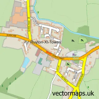
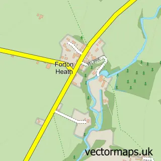
More street maps in Shropshire
750 metre map area coverage
Boundary, postcode and point of interest information for the 750m x 750m rectangle centred on this sample map.
Boundaries containing map centre
Constituency: North Shropshire Co Const
District: Shropshire
Icb: NHS Shropshire Telford and Wrekin ICB
Parish: Baschurch CP
Police Force: west mercia
Postcode District: SY4
Postcode Sector: SY4 2
Nearby boundaries intersecting sample
No additional intersecting boundaries found.
Postcode coverage
POI category counts
Automotive Repair: 3
Indian Restaurant: 3
Coffee Shop: 2
Elementary School: 2
Anglican Church: 1
Assisted Living Facility: 1
Atms: 1
Auto Glass Service: 1
Auto Loan Provider: 1
Beauty Salon: 1
Sample points of interest
- Baschurch All Saints
- Briery Lodge Care Home
- BR Spar Baschurch
- All Shropshire Windscreens
- Martin Mortgages
- Church Road Garage
- Newtown Garage and MOT
- Unipart Car Care Centre
- Divine You
- All Saints Church
- Costa Coffee
- Costa Express
Create a larger editable map of Baschurch
This sample shows only a 750 metre area. To create a larger map of Baschurch, use our map builder to choose your own coverage area, add titles and download editable SVG, PDF and PNG files.
Create a custom map of Baschurch