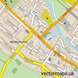
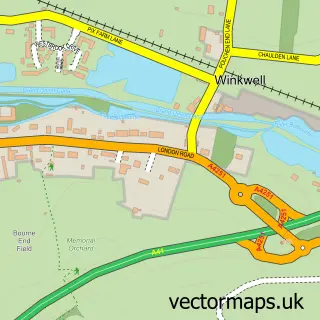
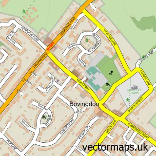
This Berkhamsted street map is a detailed vector street map covering a 750m x 750m area. Select a larger area to create and download your own vector street map of Berkhamsted.
The 750-metre map sample for Berkhamsted covers 321 mapped buildings and approximately 32.8 km of road detail, of which 41 named roads are named. The immediate area includes 2 schools, 1 railway station, 2 GP surgeries within 2 miles and 7 pubs among other local services. The wider area around Berkhamsted features 6 tourism points of interest, 37 food and drink venues and 2 hotels. To create a larger or custom map of Berkhamsted, the map builder lets you define your own coverage area and download editable SVG, PDF and PNG files.
Create a larger editable map of Berkhamsted
Choose any area you need and generate a high-quality vector map instantly. Perfect for print, planning, design, business and personal use.

This Berkhamsted street map in Hertfordshire is available as downloadable SVG, PDF and PNG map files, or as a printed map for planning, business, display, education, local information and design work. You can also create a larger custom map area using the map selector.
What this Berkhamsted map sample shows
Berkhamsted lies within Berkhamsted Cp parish, part of Berkhamsted East ward in the Dacorum District (B) local authority area. The postcode geography for this area includes the HP postcode area, the HP4 postcode district and the HP4 1 postcode sector. Residents fall under the Nhs Hertfordshire And West Essex Integrated Care Board for NHS services.
Local features near Berkhamsted
Within 2 milesAmenities and services in and around Berkhamsted.
Administrative and postcode information for Berkhamsted
The local authority covering Berkhamsted is Dacorum District (B), within the county of Hertfordshire. The settlement lies within Berkhamsted East ward and Berkhamsted Cp civil parish. The HP4 postcode district and HP4 1 postcode sector serve the immediate area. NHS provision in the area is delivered through West Hertfordshire Teaching Hospitals Nhs Trust.
Nearby street map samples around Berkhamsted

More street maps in Hertfordshire
750 metre map area coverage
Boundary, postcode and point of interest information for the 750m x 750m rectangle centred on this sample map.
Boundaries containing map centre
Constituency: Harpenden and Berkhamsted Co Const
County: Hertfordshire County
District: Dacorum District (B)
Icb: NHS Central East ICB
Parish: Berkhamsted CP
Police Force: hertfordshire
Postcode District: HP4
Postcode Sector: HP4 3
Ward: Berkhamsted Castle Ward
Nearby boundaries intersecting sample
Postcode Sector: HP4 1, HP4 2
Ward: Berkhamsted East Ward
Postcode coverage
POI category counts
Employment Agencies: 27
Professional Services: 25
Real Estate Agent: 22
Hair Salon: 16
Clothing Store: 12
Advertising Agency: 11
Beauty Salon: 11
Coffee Shop: 11
Cafe: 10
Dentist: 10
Sample points of interest
- Allazo Accounting and Consultancy
- Griffiths Preston
- Griffiths Preston
- Harts
- Neame & Co Chartered Accountants & Business Advisors
- TaxAssist Accountants
- Ashridge Karate Academy
- Limitless Fitness
- Limitless Life
- Acupuncture in Herts
- L A
- Rebecca Cox - WhiteLeaf Acupuncture
Create a larger editable map of Berkhamsted
This sample shows only a 750 metre area. To create a larger map of Berkhamsted, use our map builder to choose your own coverage area, add titles and download editable SVG, PDF and PNG files.
Create a custom map of Berkhamsted