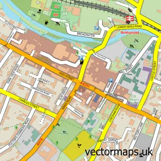
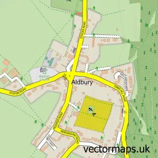
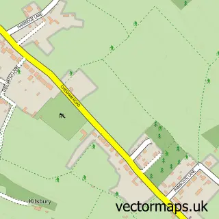
This Northchurch street map is a detailed vector street map covering a 750m x 750m area. Select a larger area to create and download your own vector street map of Northchurch.
The 750-metre map sample for Northchurch covers 427 mapped buildings and approximately 36.4 km of road detail, of which 38 named roads are named. The immediate area includes 1 school, 2 GP surgeries within 2 miles, 1 pub and 8 MOT stations within 2 miles. The wider area around Northchurch features 3 tourism points of interest and 1 food and drink venue. To create a larger or custom map of Northchurch, the map builder lets you define your own coverage area and download editable SVG, PDF and PNG files.
Create a larger editable map of Northchurch
Choose any area you need and generate a high-quality vector map instantly. Perfect for print, planning, design, business and personal use.

This Northchurch street map in Hertfordshire is available as downloadable SVG, PDF and PNG map files, or as a printed map for planning, business, display, education, local information and design work. You can also create a larger custom map area using the map selector.
What this Northchurch map sample shows
Northchurch lies within Northchurch Cp parish, part of Northchurch ward in the Dacorum District (B) local authority area. The postcode geography for this area includes the HP postcode area, the HP4 postcode district and the HP4 3 postcode sector. Residents fall under the Nhs Hertfordshire And West Essex Integrated Care Board for NHS services.
Local features near Northchurch
Within 2 milesAmenities and services in and around Northchurch.
Administrative and postcode information for Northchurch
The local authority covering Northchurch is Dacorum District (B), within the county of Hertfordshire. The settlement lies within Northchurch ward and Northchurch Cp civil parish. The HP4 postcode district and HP4 3 postcode sector serve the immediate area. NHS provision in the area is delivered through West Hertfordshire Teaching Hospitals Nhs Trust.
Nearby street map samples around Northchurch

More street maps in Hertfordshire
750 metre map area coverage
Boundary, postcode and point of interest information for the 750m x 750m rectangle centred on this sample map.
Boundaries containing map centre
Constituency: Harpenden and Berkhamsted Co Const
County: Hertfordshire County
District: Dacorum District (B)
Icb: NHS Central East ICB
Parish: Northchurch CP
Police Force: hertfordshire
Postcode District: HP4
Postcode Sector: HP4 3
Ward: Northchurch Ward
Nearby boundaries intersecting sample
Parish: Berkhamsted CP
Postcode Sector: HP4 1
Ward: Berkhamsted Castle Ward, Berkhamsted West Ward
Postcode coverage
POI category counts
Elementary School: 3
Professional Services: 3
Automotive Repair: 2
Contractor: 2
Counseling And Mental Health: 2
Electrician: 2
Employment Agencies: 2
Information Technology Company: 2
It Service And Computer Repair: 2
Linen: 2
Sample points of interest
- Two Oaks Pony Sanctuary
- Northchurch Recreation Ground
- Lura Car Valeting
- JJ Electrical
- Dave Seymour Auto Repairs
- Frank & Jakes Garage
- Northchurch Baptist Church
- Ciente
- Ontap Home Water Filter Systems
- Tesco Express
- Northchurch Lock No49
- Berkhamsted Castle
Create a larger editable map of Northchurch
This sample shows only a 750 metre area. To create a larger map of Northchurch, use our map builder to choose your own coverage area, add titles and download editable SVG, PDF and PNG files.
Create a custom map of Northchurch