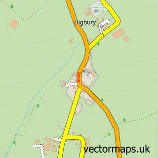
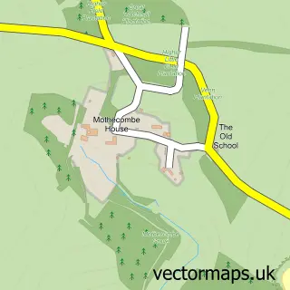
This Bigbury-on-Sea street map is a detailed vector street map covering a 750m x 750m area. Select a larger area to create and download your own vector street map of Bigbury-on-Sea.
The 750-metre map sample for Bigbury-on-Sea covers 138 mapped buildings and approximately 4.8 km of road detail, of which 6 named roads are named. The immediate area includes 1 pub. The wider area around Bigbury-on-Sea features 5 food and drink venues, 1 hotel and 2 campsites within 2 miles. To create a larger or custom map of Bigbury-on-Sea, the map builder lets you define your own coverage area and download editable SVG, PDF and PNG files.
Create a larger editable map of Bigbury-on-Sea
Choose any area you need and generate a high-quality vector map instantly. Perfect for print, planning, design, business and personal use.

This Bigbury-on-Sea street map in Devon is available as downloadable SVG, PDF and PNG map files, or as a printed map for planning, business, display, education, local information and design work. You can also create a larger custom map area using the map selector.
What this Bigbury-on-Sea map sample shows
Bigbury-on-Sea lies within Bigbury Cp parish, part of Charterlands ward in the South Hams District local authority area. Residents fall under the Nhs Devon Integrated Care Board for NHS services.
Local features near Bigbury-on-Sea
Within 2 milesAmenities and services in and around Bigbury-on-Sea.
Administrative and postcode information for Bigbury-on-Sea
The local authority covering Bigbury-on-Sea is South Hams District, within the county of Devon. The settlement lies within Charterlands ward and Bigbury Cp civil parish. NHS services are coordinated through the Nhs Devon Integrated Care Board.
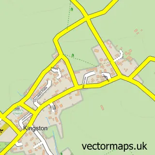
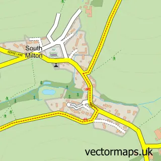
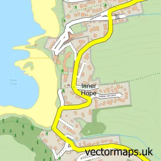
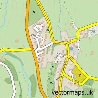
Nearby street map samples around Bigbury-on-Sea

More street maps in Devon
750 metre map area coverage
Boundary, postcode and point of interest information for the 750m x 750m rectangle centred on this sample map.
Boundaries containing map centre
Constituency: South Devon Co Const
County: Devon County
District: South Hams District
Icb: NHS Devon ICB
Parish: Bigbury CP
Police Force: devon and cornwall
Postcode District: TQ7
Postcode Sector: TQ7 4
Ward: Charterlands Ward
Nearby boundaries intersecting sample
No additional intersecting boundaries found.
Postcode coverage
POI category counts
Beach: 3
Holiday Rental Home: 3
Restaurant: 2
Accommodation: 1
Bar: 1
Cafe: 1
Coffee Shop: 1
Cottage: 1
Flowers And Gifts Shop: 1
Food Beverage Service Distribution: 1
Sample points of interest
- Burgh Island Causeway Apartments
- The Deck at The Causeway, Burgh Island Causeway, Bigbury on Sea.
- Bigbury Bay
- Bigbury Beach
- Challisborough Beach
- Venus Cafe
- BeachBarista
- Swiss Cottage, Bigbury on Sea
- The Bigbury Beach Shop
- Local Food Advisor
- Bigbury Beach Shop
- South West Coast Path - Burgh Island
Create a larger editable map of Bigbury-on-Sea
This sample shows only a 750 metre area. To create a larger map of Bigbury-on-Sea, use our map builder to choose your own coverage area, add titles and download editable SVG, PDF and PNG files.
Create a custom map of Bigbury-on-Sea