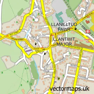
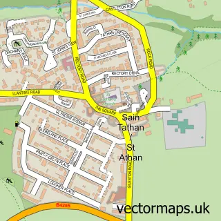
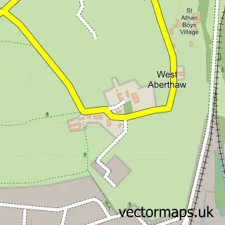
This Boverton street map is a detailed vector street map covering a 750m x 750m area. Select a larger area to create and download your own vector street map of Boverton.
The 750-metre map sample for Boverton covers 294 mapped buildings and approximately 17.4 km of road detail, of which 23 named roads are named. The immediate area includes 1 GP surgery within 2 miles, 1 pub and 2 MOT stations within 2 miles. The wider area around Boverton features 1 food and drink venue and 2 campsites within 2 miles. To create a larger or custom map of Boverton, the map builder lets you define your own coverage area and download editable SVG, PDF and PNG files.
Create a larger editable map of Boverton
Choose any area you need and generate a high-quality vector map instantly. Perfect for print, planning, design, business and personal use.

This Boverton street map in South Glamorgan is available as downloadable SVG, PDF and PNG map files, or as a printed map for planning, business, display, education, local information and design work. You can also create a larger custom map area using the map selector.
What this Boverton map sample shows
Boverton lies within Llantwit Major Community parish, part of Llantwit Major ward in the Bro Morgannwg - The Vale Of Glamorgan local authority area. The postcode geography for this area includes the CF postcode area, the CF61 postcode district and the CF61 1 postcode sector. Residents fall under the Cardiff And Vale University Health Board for NHS services.
Local features near Boverton
Within 2 milesAmenities and services in and around Boverton.
Administrative and postcode information for Boverton
Boverton lies within Llantwit Major Community parish, part of Llantwit Major ward in the Bro Morgannwg - The Vale Of Glamorgan local authority area. The postcode geography for this area includes the CF postcode area, the CF61 postcode district and the CF61 1 postcode sector. Residents fall under the Cardiff And Vale University Health Board for NHS services.
Nearby street map samples around Boverton

More street maps in South Glamorgan
750 metre map area coverage
Boundary, postcode and point of interest information for the 750m x 750m rectangle centred on this sample map.
Boundaries containing map centre
Constituency: Vale of Glamorgan Co Const
District: Bro Morgannwg - the Vale of Glamorgan
Icb: Cardiff and Vale University
Parish: Llantwit Major Community
Police Force: south wales
Postcode District: CF61
Postcode Sector: CF61 1
Nearby boundaries intersecting sample
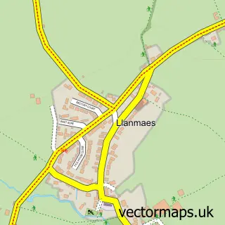
Parish: Llanmaes Community
Postcode Sector: CF61 2
Postcode coverage
POI category counts
Courier And Delivery Services: 2
Supermarket: 2
Barber: 1
Beauty Salon: 1
Business Management Services: 1
Contractor: 1
Convenience Store: 1
Dog Park: 1
Engine Repair Service: 1
Fish And Chips Restaurant: 1
Sample points of interest
- Blockleys Barbers
- JP Hairstudio
- Boverton Post Office
- Cosier Homes
- Bargain Booze Select Convenience
- D & G Courier Solutions
- D&g Courier Solutions
- Boverton Brook
- A 2 Z Locksmiths
- Farnham's at Boverton
- Thai Story
- The Cutting Room
Create a larger editable map of Boverton
This sample shows only a 750 metre area. To create a larger map of Boverton, use our map builder to choose your own coverage area, add titles and download editable SVG, PDF and PNG files.
Create a custom map of Boverton