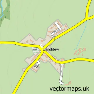
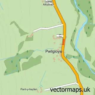
This Brecon street map is a detailed vector street map covering a 750m x 750m area. Select a larger area to create and download your own vector street map of Brecon.
The 750-metre map sample for Brecon covers 324 mapped buildings and approximately 62.2 km of road detail, of which 65 named roads are named. The immediate area includes 3 schools, 12 pubs and 4 MOT stations, with 9 within 2 miles. The wider area around Brecon features 12 tourism points of interest, 30 food and drink venues and 7 hotels. To create a larger or custom map of Brecon, the map builder lets you define your own coverage area and download editable SVG, PDF and PNG files.
Create a larger editable map of Brecon
Choose any area you need and generate a high-quality vector map instantly. Perfect for print, planning, design, business and personal use.

This Brecon street map in Powys is available as downloadable SVG, PDF and PNG map files, or as a printed map for planning, business, display, education, local information and design work. You can also create a larger custom map area using the map selector.
What this Brecon map sample shows
Brecon lies within Brecon Community parish, part of St. Mary ward in the Powys - Powys local authority area. The postcode geography for this area includes the LD postcode area, the LD3 postcode district and the LD3 7 postcode sector. Residents fall under the Powys Teaching Health Board for NHS services.
Local features near Brecon
Within 2 milesAmenities and services in and around Brecon.
Administrative and postcode information for Brecon
The local authority covering Brecon is Powys - Powys, within the county of Powys. The settlement lies within St. Mary ward and Brecon Community civil parish. The LD3 postcode district and LD3 7 postcode sector serve the immediate area. NHS provision in the area is delivered through Powys Teaching Health Board.
Nearby street map samples around Brecon


More street maps in Powys
750 metre map area coverage
Boundary, postcode and point of interest information for the 750m x 750m rectangle centred on this sample map.
Boundaries containing map centre
Constituency: Brecon, Radnor and Cwm Tawe Co Const
District: Powys - Powys
Icb: Powys Teaching
Parish: Brecon Community
Police Force: dyfed-powys
Postcode District: LD3
Postcode Sector: LD3 7
Nearby boundaries intersecting sample
Postcode Sector: LD3 8, LD3 9
Postcode coverage
POI category counts
Beauty Salon: 12
Bed And Breakfast: 12
Pub: 12
Hair Salon: 11
Professional Services: 10
Charity Organization: 8
Flowers And Gifts Shop: 8
Art Gallery: 7
Cafe: 7
Hotel: 7
Sample points of interest
- The Guildhall
- Woodland Park Glamping
- Mitchell Associates
- Mitchell Meredith Ltd.
- Roche-Saunders & Co.
- W J James and Co Chartered Accountants
- Fitness Brecon
- Powys Drugs & Alcohol Centre
- Alternative Tune Lucy Mason
- Brecon Complimentary Medicine Centre
- D J Rodway
- Now Most Co
Create a larger editable map of Brecon
This sample shows only a 750 metre area. To create a larger map of Brecon, use our map builder to choose your own coverage area, add titles and download editable SVG, PDF and PNG files.
Create a custom map of Brecon