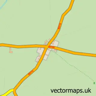
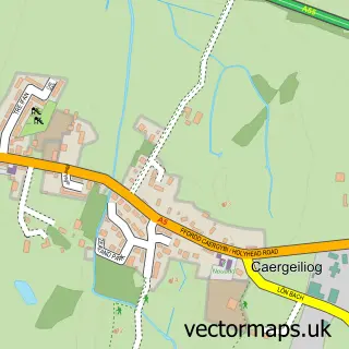
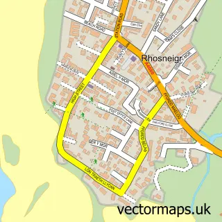
This Bryngwran street map is a detailed vector street map covering a 750m x 750m area. Select a larger area to create and download your own vector street map of Bryngwran.
The 750-metre map sample for Bryngwran covers 187 mapped buildings and approximately 7.8 km of road detail, of which 11 named roads are named. The immediate area includes 1 school, 2 GP surgeries within 2 miles, 2 pubs and 1 MOT station, with 3 within 2 miles. The wider area around Bryngwran features 3 food and drink venues and 2 campsites within 2 miles. To create a larger or custom map of Bryngwran, the map builder lets you define your own coverage area and download editable SVG, PDF and PNG files.
Create a larger editable map of Bryngwran
Choose any area you need and generate a high-quality vector map instantly. Perfect for print, planning, design, business and personal use.

This Bryngwran street map in Gwynedd is available as downloadable SVG, PDF and PNG map files, or as a printed map for planning, business, display, education, local information and design work. You can also create a larger custom map area using the map selector.
What this Bryngwran map sample shows
Bryngwran lies within Bryngwran Community parish, part of Canolbarth Mwn ward in the Sir Ynys Mon - Isle Of Anglesey local authority area. The postcode geography for this area includes the LL postcode area, the LL65 postcode district and the LL65 3 postcode sector. Residents fall under the Betsi Cadwaladr University Health Board for NHS services.
Local features near Bryngwran
Within 2 milesAmenities and services in and around Bryngwran.
Administrative and postcode information for Bryngwran
Bryngwran lies within Bryngwran Community parish, part of Canolbarth Mwn ward in the Sir Ynys Mon - Isle Of Anglesey local authority area. The postcode geography for this area includes the LL postcode area, the LL65 postcode district and the LL65 3 postcode sector. Residents fall under the Betsi Cadwaladr University Health Board for NHS services.
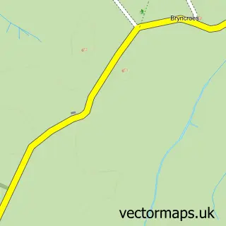
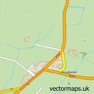
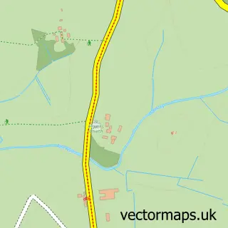
Nearby street map samples around Bryngwran

More street maps in Gwynedd
750 metre map area coverage
Boundary, postcode and point of interest information for the 750m x 750m rectangle centred on this sample map.
Boundaries containing map centre
Constituency: Ynys Mon Co Const
District: Sir Ynys Mon - Isle of Anglesey
Icb: Betsi Cadwaladr University
Parish: Bryngwran Community
Police Force: north wales
Postcode District: LL65
Postcode Sector: LL65 3
Nearby boundaries intersecting sample
No additional intersecting boundaries found.
Postcode coverage
POI category counts
Pub: 2
Arts And Crafts: 1
Bar: 1
Beauty And Spa: 1
Building Supply Store: 1
Cafe: 1
Contractor: 1
Holiday Rental Home: 1
Laundromat: 1
Linen: 1
Sample points of interest
- Mayfly Mosaics
- Philfest
- The Nail and Beauty Shed
- T J Evans Roofing Ltd
- Matt's Pantry
- GT Granite & Tiling services
- Mountain View Holiday Let - Anglesey
- Equash
- Lloyds Blinds
- Renaissance Masonry & Construction
- Plas Crigyll
- AngleseyMusic
Create a larger editable map of Bryngwran
This sample shows only a 750 metre area. To create a larger map of Bryngwran, use our map builder to choose your own coverage area, add titles and download editable SVG, PDF and PNG files.
Create a custom map of Bryngwran