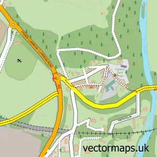
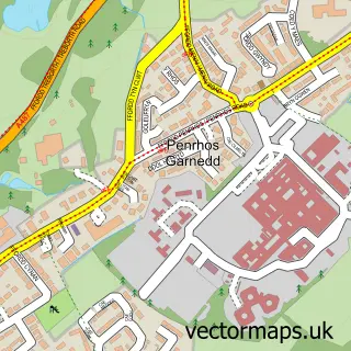
This Bangor street map is a detailed vector street map covering a 750m x 750m area. Select a larger area to create and download your own vector street map of Bangor.
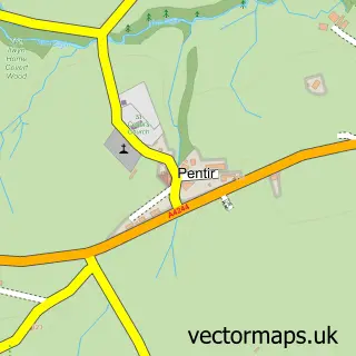
The 750-metre map sample for Bangor covers 211 mapped buildings and approximately 18.7 km of road detail, of which 46 named roads are named. The immediate area includes 2 schools, 1 GP surgery within 2 miles, 8 pubs and 1 MOT station, with 7 within 2 miles. The wider area around Bangor features 7 tourism points of interest, 26 food and drink venues and 1 campsite within 2 miles. To create a larger or custom map of Bangor, the map builder lets you define your own coverage area and download editable SVG, PDF and PNG files.
Create a larger editable map of Bangor
Choose any area you need and generate a high-quality vector map instantly. Perfect for print, planning, design, business and personal use.

This Bangor street map in Gwynedd is available as downloadable SVG, PDF and PNG map files, or as a printed map for planning, business, display, education, local information and design work. You can also create a larger custom map area using the map selector.
What this Bangor map sample shows
Bangor lies within Llandygai Community parish, part of Arllechwedd ward in the Gwynedd - Gwynedd local authority area. The postcode geography for this area includes the LL postcode area, the LL57 postcode district and the LL57 4 postcode sector. Residents fall under the Betsi Cadwaladr University Health Board for NHS services.
Local features near Bangor
Within 2 milesAmenities and services in and around Bangor.
Administrative and postcode information for Bangor
Bangor lies within Llandygai Community parish, part of Arllechwedd ward in the Gwynedd - Gwynedd local authority area. The postcode geography for this area includes the LL postcode area, the LL57 postcode district and the LL57 4 postcode sector. Residents fall under the Betsi Cadwaladr University Health Board for NHS services.
Nearby street map samples around Bangor

More street maps in Gwynedd
750 metre map area coverage
Boundary, postcode and point of interest information for the 750m x 750m rectangle centred on this sample map.
Boundaries containing map centre
Constituency: Bangor Aberconwy Co Const
District: Gwynedd - Gwynedd
Icb: Betsi Cadwaladr University
Parish: Bangor Community
Police Force: north wales
Postcode District: LL57
Postcode Sector: LL57 1
Nearby boundaries intersecting sample
Postcode Sector: LL57 2
Postcode coverage
POI category counts
College University: 27
Beauty Salon: 19
Clothing Store: 13
Mobile Phone Store: 11
Bank Credit Union: 9
Barber: 8
Cafe: 8
Childrens Clothing Store: 8
Pub: 8
Charity Organization: 7
Sample points of interest
- Llandwyn
- Llys Y Deon
- 1PUTT
- American Shack
- City Leisure & Snooker Club
- Annie's Orphans
- Scope Charity Shop
- Stiwdio 9
- Storiel
- Bangor Museum & Art Gallery
- 109 Bangor
- Printing & Embroidery
Create a larger editable map of Bangor
This sample shows only a 750 metre area. To create a larger map of Bangor, use our map builder to choose your own coverage area, add titles and download editable SVG, PDF and PNG files.
Create a custom map of Bangor