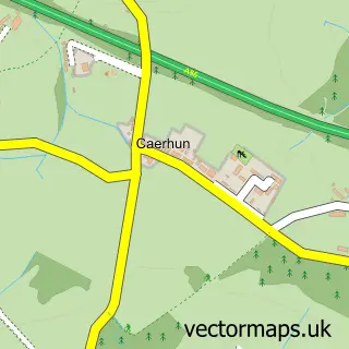
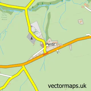
This Penrhos Garnedd street map is a detailed vector street map covering a 750m x 750m area. Select a larger area to create and download your own vector street map of Penrhos Garnedd.
The 750-metre map sample for Penrhos Garnedd covers 285 mapped buildings and approximately 16.1 km of road detail, of which 24 named roads are named. The immediate area includes 1 GP surgery within 2 miles and 7 MOT stations within 2 miles. The wider area around Penrhos Garnedd features 2 food and drink venues and 1 campsite within 2 miles. To create a larger or custom map of Penrhos Garnedd, the map builder lets you define your own coverage area and download editable SVG, PDF and PNG files.
Create a larger editable map of Penrhos Garnedd
Choose any area you need and generate a high-quality vector map instantly. Perfect for print, planning, design, business and personal use.

This Penrhos Garnedd street map in Gwynedd is available as downloadable SVG, PDF and PNG map files, or as a printed map for planning, business, display, education, local information and design work. You can also create a larger custom map area using the map selector.
What this Penrhos Garnedd map sample shows
Penrhos Garnedd lies within Menai Bridge Community parish, part of Aethwy ward in the Sir Ynys Mon - Isle Of Anglesey local authority area. The postcode geography for this area includes the LL postcode area, the LL59 postcode district and the LL59 5 postcode sector. Local NHS services are provided through Betsi Cadwaladr University Health Board.
Local features near Penrhos Garnedd
Within 2 milesAmenities and services in and around Penrhos Garnedd.
Administrative and postcode information for Penrhos Garnedd
The local authority covering Penrhos Garnedd is Sir Ynys Mon - Isle Of Anglesey, within the county of Gwynedd. The settlement lies within Aethwy ward and Menai Bridge Community civil parish. The LL59 postcode district and LL59 5 postcode sector serve the immediate area. NHS provision in the area is delivered through Betsi Cadwaladr University Health Board.
Nearby street map samples around Penrhos Garnedd


More street maps in Gwynedd
750 metre map area coverage
Boundary, postcode and point of interest information for the 750m x 750m rectangle centred on this sample map.
Boundaries containing map centre
Constituency: Bangor Aberconwy Co Const
District: Gwynedd - Gwynedd
Icb: Betsi Cadwaladr University
Parish: Pentir Community
Police Force: north wales
Postcode District: LL57
Postcode Sector: LL57 2
Nearby boundaries intersecting sample
Parish: Bangor Community
Postcode Sector: LL57 4
Postcode coverage
POI category counts
Hospital: 9
Atms: 3
Post Office: 3
Roofing: 3
Convenience Store: 2
Retail: 2
Arts And Crafts: 1
Building Supply Store: 1
Cafe: 1
Car Rental Agency: 1
Sample points of interest
- Silken Strands & Fantasy Fabrics
- Bangor Hospital (Protected), Penrhosgarnedd
- Bangor Hospital, Penrhos Garnedd
- Penrhosgarned Post Office/Convenience Extra
- Tryfan Flat Roofing
- Treborth Nurseries
- Practical Car & Van Rental
- British Red Cross
- China City
- Cyfeillion Ysbyty Gwynedd
- A L Hughes plastering
- One Stop
Create a larger editable map of Penrhos Garnedd
This sample shows only a 750 metre area. To create a larger map of Penrhos Garnedd, use our map builder to choose your own coverage area, add titles and download editable SVG, PDF and PNG files.
Create a custom map of Penrhos Garnedd