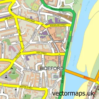
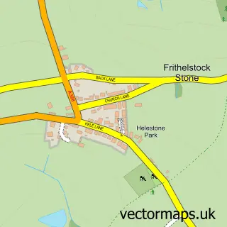
This Buckland Brewer street map is a detailed vector street map covering a 750m x 750m area. Select a larger area to create and download your own vector street map of Buckland Brewer.
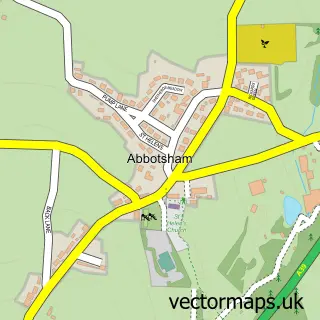
The 750-metre map sample for Buckland Brewer covers 250 mapped buildings and approximately 19.5 km of road detail, of which 11 named roads are named. The immediate area includes 1 school. To create a larger or custom map of Buckland Brewer, the map builder lets you define your own coverage area and download editable SVG, PDF and PNG files.
Create a larger editable map of Buckland Brewer
Choose any area you need and generate a high-quality vector map instantly. Perfect for print, planning, design, business and personal use.

This Buckland Brewer street map in Devon is available as downloadable SVG, PDF and PNG map files, or as a printed map for planning, business, display, education, local information and design work. You can also create a larger custom map area using the map selector.
What this Buckland Brewer map sample shows
Buckland Brewer lies within Buckland Brewer Cp parish, part of Monkleigh & Putford ward in the Torridge District local authority area. The postcode geography for this area includes the EX postcode area, the EX39 postcode district and the EX39 5 postcode sector. Residents fall under the Nhs Devon Integrated Care Board for NHS services.
Local features near Buckland Brewer
Within 2 milesAmenities and services in and around Buckland Brewer.
Administrative and postcode information for Buckland Brewer
The local authority covering Buckland Brewer is Torridge District, within the county of Devon. The settlement lies within Monkleigh & Putford ward and Buckland Brewer Cp civil parish. The EX39 postcode district and EX39 5 postcode sector serve the immediate area. NHS provision in the area is delivered through Northern Devon Nhs Trust.
Nearby street map samples around Buckland Brewer

More street maps in Devon
750 metre map area coverage
Boundary, postcode and point of interest information for the 750m x 750m rectangle centred on this sample map.
Boundaries containing map centre
Constituency: Torridge and Tavistock Co Const
County: Devon County
District: Torridge District
Icb: NHS Devon ICB
Parish: Buckland Brewer CP
Police Force: devon and cornwall
Postcode District: EX39
Postcode Sector: EX39 5
Ward: Monkleigh & Putford Ward
Nearby boundaries intersecting sample
Parish: Parkham CP
Ward: Hartland Ward
Postcode coverage
POI category counts
Anglican Church: 1
Bar: 1
Bridal Shop: 1
Church Cathedral: 1
Community Services Non Profits: 1
Convenience Store: 1
Cottage: 1
Elementary School: 1
Gastropub: 1
Holiday Rental Home: 1
Sample points of interest
- St Mary and St Benedict
- Coach & Horses At Buckland Brewer
- Jayne Shere
- Buckland Brewer Methodist Church
- Buckland Brewer Village
- Buckland Brewer Community Shop
- Buckland Barn Holiday cottage
- Buckland Brewer Community Primary School
- Coach & Horses
- Rustic and Rural Retreats
- Allison Homes - Foxglove View
- Titanium Computer Repairs
Create a larger editable map of Buckland Brewer
This sample shows only a 750 metre area. To create a larger map of Buckland Brewer, use our map builder to choose your own coverage area, add titles and download editable SVG, PDF and PNG files.
Create a custom map of Buckland Brewer