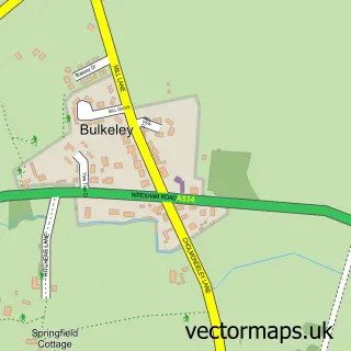
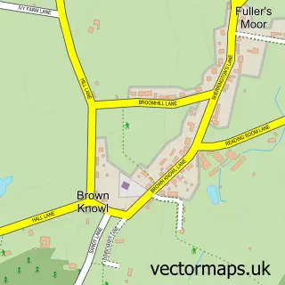
This Burwardsley street map is a detailed vector street map covering a 750m x 750m area. Select a larger area to create and download your own vector street map of Burwardsley.
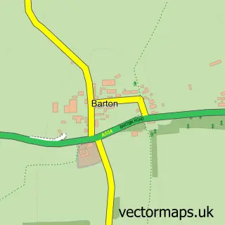
The 750-metre map sample for Burwardsley covers 57 mapped buildings and approximately 7.7 km of road detail, of which 5 named roads are named. The wider area around Burwardsley features 1 tourism point of interest, 2 food and drink venues and 2 campsites within 2 miles. To create a larger or custom map of Burwardsley, the map builder lets you define your own coverage area and download editable SVG, PDF and PNG files.
Create a larger editable map of Burwardsley
Choose any area you need and generate a high-quality vector map instantly. Perfect for print, planning, design, business and personal use.

This Burwardsley street map in Cheshire is available as downloadable SVG, PDF and PNG map files, or as a printed map for planning, business, display, education, local information and design work. You can also create a larger custom map area using the map selector.
What this Burwardsley map sample shows
Burwardsley lies within Burwardsley Cp parish, part of Tattenhall ward in the Cheshire West And Chester (B) local authority area. The postcode geography for this area includes the CH postcode area, the CH3 postcode district and the CH3 9 postcode sector. Residents fall under the Nhs Cheshire And Merseyside Integrated Care Board for NHS services.
Local features near Burwardsley
Within 2 milesAmenities and services in and around Burwardsley.
Administrative and postcode information for Burwardsley
Burwardsley lies within Burwardsley Cp parish, part of Tattenhall ward in the Cheshire West And Chester (B) local authority area. The postcode geography for this area includes the CH postcode area, the CH3 postcode district and the CH3 9 postcode sector. Residents fall under the Nhs Cheshire And Merseyside Integrated Care Board for NHS services.
Nearby street map samples around Burwardsley

More street maps in Cheshire
750 metre map area coverage
Boundary, postcode and point of interest information for the 750m x 750m rectangle centred on this sample map.
Boundaries containing map centre
Constituency: Chester South and Eddisbury Co Const
District: Cheshire West and Chester (B)
Icb: NHS Cheshire and Merseyside ICB
Parish: Burwardsley CP
Police Force: cheshire
Postcode District: CH3
Postcode Sector: CH3 9
Ward: Tattenhall Ward
Nearby boundaries intersecting sample
No additional intersecting boundaries found.
Postcode coverage
POI category counts
Forestry Service: 2
Post Office: 2
Active Life: 1
Anglican Church: 1
Art Gallery: 1
Cafe: 1
Church Cathedral: 1
Coffee Shop: 1
Community Center: 1
Community Services Non Profits: 1
Sample points of interest
- Burwardsley Outdoor Centre
- St John the Evangelist
- Lady Longhorn Gallery
- The Poffee
- St John's Church
- Burwardsley village store and post office
- Burwardsley Village Hall
- Burwardsley Village Hall Institute
- Global Air Training
- Global Air Training
- Mamex Farms Limited
- Treefellers
Create a larger editable map of Burwardsley
This sample shows only a 750 metre area. To create a larger map of Burwardsley, use our map builder to choose your own coverage area, add titles and download editable SVG, PDF and PNG files.
Create a custom map of Burwardsley