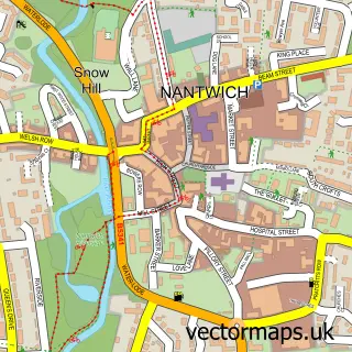
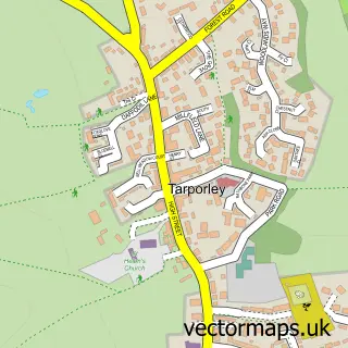
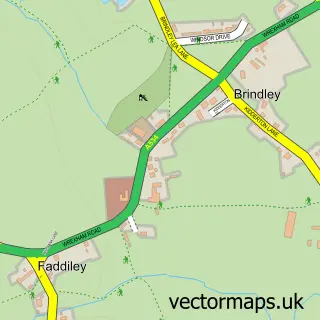
This Bunbury street map is a detailed vector street map covering a 750m x 750m area. Select a larger area to create and download your own vector street map of Bunbury.
The 750-metre map sample for Bunbury covers 353 mapped buildings and approximately 12.7 km of road detail, of which 23 named roads are named. The immediate area includes 1 school, 1 GP surgery and 1 pub. The wider area around Bunbury features 2 tourism points of interest and 4 food and drink venues. To create a larger or custom map of Bunbury, the map builder lets you define your own coverage area and download editable SVG, PDF and PNG files.
Create a larger editable map of Bunbury
Choose any area you need and generate a high-quality vector map instantly. Perfect for print, planning, design, business and personal use.

This Bunbury street map in Cheshire is available as downloadable SVG, PDF and PNG map files, or as a printed map for planning, business, display, education, local information and design work. You can also create a larger custom map area using the map selector.
What this Bunbury map sample shows
Bunbury lies within Bunbury Cp parish, part of Bunbury ward in the Cheshire East (B) local authority area. The postcode geography for this area includes the CW postcode area, the CW6 postcode district and the CW6 9 postcode sector. Residents fall under the Nhs Cheshire And Merseyside Integrated Care Board for NHS services.
Local features near Bunbury
Within 2 milesAmenities and services in and around Bunbury.
Administrative and postcode information for Bunbury
The local authority covering Bunbury is Cheshire East (B), within the county of Cheshire. The settlement lies within Bunbury ward and Bunbury Cp civil parish. The CW6 postcode district and CW6 9 postcode sector serve the immediate area. NHS provision in the area is delivered through Mid Cheshire Hospitals Nhs Foundation Trust.
Nearby street map samples around Bunbury

More street maps in Cheshire
750 metre map area coverage
Boundary, postcode and point of interest information for the 750m x 750m rectangle centred on this sample map.
Boundaries containing map centre
Constituency: Chester South and Eddisbury Co Const
District: Cheshire East (B)
Icb: NHS Cheshire and Merseyside ICB
Parish: Bunbury CP
Police Force: cheshire
Postcode District: CW6
Postcode Sector: CW6 9
Ward: Bunbury Ward
Nearby boundaries intersecting sample
Parish: Spurstow CP
Ward: Wrenbury Ward
Postcode coverage
POI category counts
Coffee Shop: 2
Elementary School: 2
Active Life: 1
Advertising Agency: 1
Alternative Medicine: 1
Architectural Designer: 1
Atms: 1
Attractions And Activities: 1
Boutique: 1
Building Supply Store: 1
Sample points of interest
- Jubilee park, Bunbury
- Peter Horridge Designs
- Aura Holistic Beauty Spa
- The Bunting Partnership Ltd
- The Cooperative Food (BF) Bunbury, Bunbury
- Bunbury Jubilee Playing Fields
- Lizella
- Carpet Cleaning Bunbury
- Tilly's Coffee Shop
- St Boniface Church
- The Sheds
- Tilly's Bunbury
Create a larger editable map of Bunbury
This sample shows only a 750 metre area. To create a larger map of Bunbury, use our map builder to choose your own coverage area, add titles and download editable SVG, PDF and PNG files.
Create a custom map of Bunbury