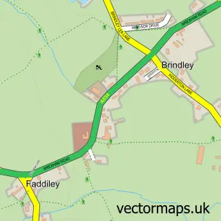
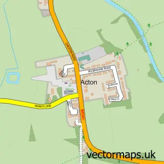
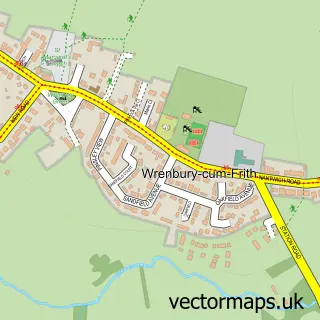
This Brindley street map is a detailed vector street map covering a 750m x 750m area. Select a larger area to create and download your own vector street map of Brindley.
The 750-metre map sample for Brindley covers 81 mapped buildings and approximately 6.9 km of road detail, of which 6 named roads are named. The immediate area includes 1 pub and 2 MOT stations within 2 miles. The wider area around Brindley features 1 food and drink venue. To create a larger or custom map of Brindley, the map builder lets you define your own coverage area and download editable SVG, PDF and PNG files.
Create a larger editable map of Brindley
Choose any area you need and generate a high-quality vector map instantly. Perfect for print, planning, design, business and personal use.

This Brindley street map in Cheshire is available as downloadable SVG, PDF and PNG map files, or as a printed map for planning, business, display, education, local information and design work. You can also create a larger custom map area using the map selector.
What this Brindley map sample shows
Brindley lies within Brindley Cp parish, part of Wrenbury ward in the Cheshire East (B) local authority area. The postcode geography for this area includes the CW postcode area, the CW5 postcode district and the CW5 8 postcode sector. Residents fall under the Nhs Cheshire And Merseyside Integrated Care Board for NHS services.
Local features near Brindley
Within 2 milesAmenities and services in and around Brindley.
Administrative and postcode information for Brindley
The local authority covering Brindley is Cheshire East (B), within the county of Cheshire. The settlement lies within Wrenbury ward and Brindley Cp civil parish. The CW5 postcode district and CW5 8 postcode sector serve the immediate area. NHS provision in the area is delivered through Mid Cheshire Hospitals Nhs Foundation Trust.
Nearby street map samples around Brindley

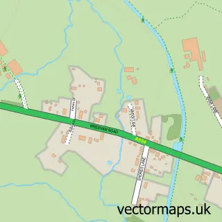
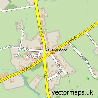
More street maps in Cheshire
750 metre map area coverage
Boundary, postcode and point of interest information for the 750m x 750m rectangle centred on this sample map.
Boundaries containing map centre
Constituency: Chester South and Eddisbury Co Const
District: Cheshire East (B)
Icb: NHS Cheshire and Merseyside ICB
Parish: Brindley CP
Police Force: cheshire
Postcode District: CW5
Postcode Sector: CW5 8
Ward: Wrenbury Ward
Nearby boundaries intersecting sample
Parish: Burland and Acton CP, Faddiley CP
Postcode coverage
POI category counts
Amateur Sports Team: 1
Day Care Preschool: 1
Farm: 1
Pub: 1
Self Storage Facility: 1
Sample points of interest
- Faddiley FC
- Rebecca's Day Nursery
- Brindley Green Farm Christmas Trees
- The Thatch
- Nantwich Self Storage
Create a larger editable map of Brindley
This sample shows only a 750 metre area. To create a larger map of Brindley, use our map builder to choose your own coverage area, add titles and download editable SVG, PDF and PNG files.
Create a custom map of Brindley