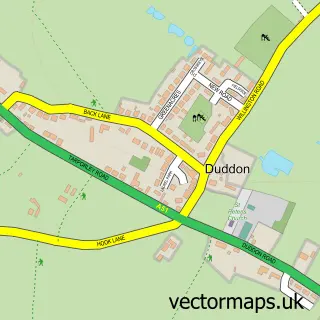
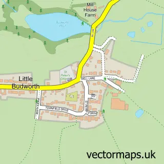
This Tarporley street map is a detailed vector street map covering a 750m x 750m area. Select a larger area to create and download your own vector street map of Tarporley.
The 750-metre map sample for Tarporley covers 327 mapped buildings and approximately 10.4 km of road detail, of which 30 named roads are named. The immediate area includes 1 school, 2 GP surgeries, 5 pubs and 1 MOT station, with 3 within 2 miles. The wider area around Tarporley features 2 tourism points of interest and 8 food and drink venues. To create a larger or custom map of Tarporley, the map builder lets you define your own coverage area and download editable SVG, PDF and PNG files.
Create a larger editable map of Tarporley
Choose any area you need and generate a high-quality vector map instantly. Perfect for print, planning, design, business and personal use.

This Tarporley street map in Cheshire is available as downloadable SVG, PDF and PNG map files, or as a printed map for planning, business, display, education, local information and design work. You can also create a larger custom map area using the map selector.
What this Tarporley map sample shows
Tarporley lies within Tarporley Cp parish, part of Tarporley ward in the Cheshire West And Chester (B) local authority area. The postcode geography for this area includes the CW postcode area, the CW6 postcode district and the CW6 0 postcode sector. Residents fall under the Nhs Cheshire And Merseyside Integrated Care Board for NHS services.
Local features near Tarporley
Within 2 milesAmenities and services in and around Tarporley.
Administrative and postcode information for Tarporley
The local authority covering Tarporley is Cheshire West And Chester (B), within the county of Cheshire. The settlement lies within Tarporley ward and Tarporley Cp civil parish. The CW6 postcode district and CW6 0 postcode sector serve the immediate area. NHS provision in the area is delivered through Countess Of Chester Hospital Nhs Foundation Trust.
Nearby street map samples around Tarporley

More street maps in Cheshire
750 metre map area coverage
Boundary, postcode and point of interest information for the 750m x 750m rectangle centred on this sample map.
Boundaries containing map centre
Constituency: Chester South and Eddisbury Co Const
District: Cheshire West and Chester (B)
Icb: NHS Cheshire and Merseyside ICB
Parish: Tarporley CP
Police Force: cheshire
Postcode District: CW6
Postcode Sector: CW6 0
Ward: Tarporley Ward
Nearby boundaries intersecting sample
No additional intersecting boundaries found.
Postcode coverage
POI category counts
Hair Salon: 9
Womens Clothing Store: 7
Beauty Salon: 6
Flowers And Gifts Shop: 6
Clothing Store: 5
Pub: 5
Real Estate Agent: 5
Barber: 4
Doctor: 4
Professional Services: 4
Sample points of interest
- Hall Livesey Brown
- Phoenix Accounts
- Phoenix Accounts
- Equiyd
- Branding Solutions
- Le Petit Monde
- Tarporley Crown Green Bowling Club
- Racewood Limited
- Dust Collectors Shop
- Consolidated Artist
- Copper Tree Gallery
- The Craft Room - Tarporley
Create a larger editable map of Tarporley
This sample shows only a 750 metre area. To create a larger map of Tarporley, use our map builder to choose your own coverage area, add titles and download editable SVG, PDF and PNG files.
Create a custom map of Tarporley