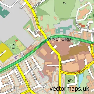
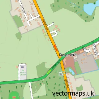
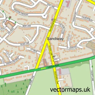
This Little Budworth street map is a detailed vector street map covering a 750m x 750m area. Select a larger area to create and download your own vector street map of Little Budworth.
The 750-metre map sample for Little Budworth covers 116 mapped buildings and approximately 3.9 km of road detail, of which 7 named roads are named. The immediate area includes 1 pub and 1 MOT station within 2 miles. The wider area around Little Budworth features 1 tourism point of interest, 1 food and drink venue and 1 campsite within 2 miles. To create a larger or custom map of Little Budworth, the map builder lets you define your own coverage area and download editable SVG, PDF and PNG files.
Create a larger editable map of Little Budworth
Choose any area you need and generate a high-quality vector map instantly. Perfect for print, planning, design, business and personal use.

This Little Budworth street map in Cheshire is available as downloadable SVG, PDF and PNG map files, or as a printed map for planning, business, display, education, local information and design work. You can also create a larger custom map area using the map selector.
What this Little Budworth map sample shows
Little Budworth lies within Little Budworth Cp parish, part of Tarporley ward in the Cheshire West And Chester (B) local authority area. The postcode geography for this area includes the CW postcode area, the CW6 postcode district and the CW6 9 postcode sector. Residents fall under the Nhs Cheshire And Merseyside Integrated Care Board for NHS services.
Local features near Little Budworth
Within 2 milesAmenities and services in and around Little Budworth.
Administrative and postcode information for Little Budworth
Little Budworth lies within Little Budworth Cp parish, part of Tarporley ward in the Cheshire West And Chester (B) local authority area. The postcode geography for this area includes the CW postcode area, the CW6 postcode district and the CW6 9 postcode sector. Residents fall under the Nhs Cheshire And Merseyside Integrated Care Board for NHS services.
Nearby street map samples around Little Budworth

More street maps in Cheshire
750 metre map area coverage
Boundary, postcode and point of interest information for the 750m x 750m rectangle centred on this sample map.
Boundaries containing map centre
Constituency: Chester South and Eddisbury Co Const
District: Cheshire West and Chester (B)
Icb: NHS Cheshire and Merseyside ICB
Parish: Little Budworth CP
Police Force: cheshire
Postcode District: CW6
Postcode Sector: CW6 9
Ward: Tarporley Ward
Nearby boundaries intersecting sample
No additional intersecting boundaries found.
Postcode coverage
POI category counts
Shipping Center: 2
Bed And Breakfast: 1
Business Management Services: 1
Carpenter: 1
Church Cathedral: 1
Community Services Non Profits: 1
Contractor: 1
Dairy Farm: 1
Park: 1
Pub: 1
Sample points of interest
- Porthkerry House Bed And Breakfast
- Busybus Ltd.
- Mckenzie Joinery
- St Peter's Church
- Cheshire Bonsai Society
- Jigsaw FM Ltd
- P Jeffs & Sons
- Little Budworth Country Park
- Red Lion, Little Budworth
- James Arnold Photography
- Little Budworth Post Office
- Post Office-Little Budworth
Create a larger editable map of Little Budworth
This sample shows only a 750 metre area. To create a larger map of Little Budworth, use our map builder to choose your own coverage area, add titles and download editable SVG, PDF and PNG files.
Create a custom map of Little Budworth