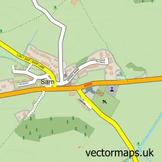
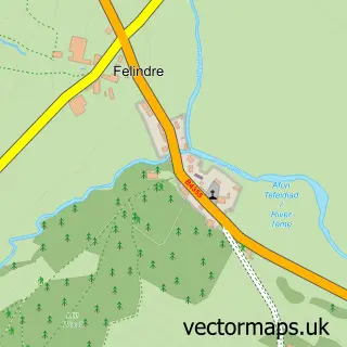
This Ceri street map is a detailed vector street map covering a 750m x 750m area. Select a larger area to create and download your own vector street map of Ceri.
The 750-metre map sample for Ceri covers 236 mapped buildings and approximately 27.4 km of road detail, of which 15 named roads are named. The immediate area includes 1 school, 2 pubs and 2 MOT stations within 2 miles. The wider area around Ceri features 2 food and drink venues. To create a larger or custom map of Ceri, the map builder lets you define your own coverage area and download editable SVG, PDF and PNG files.
Create a larger editable map of Ceri
Choose any area you need and generate a high-quality vector map instantly. Perfect for print, planning, design, business and personal use.

This Ceri street map in Powys is available as downloadable SVG, PDF and PNG map files, or as a printed map for planning, business, display, education, local information and design work. You can also create a larger custom map area using the map selector.
What this Ceri map sample shows
Ceri lies within Kerry Community parish, part of Kerry ward in the Powys - Powys local authority area. The postcode geography for this area includes the SY postcode area, the SY16 postcode district and the SY16 4 postcode sector. Residents fall under the Powys Teaching Health Board for NHS services.
Local features near Ceri
Within 2 milesAmenities and services in and around Ceri.
Administrative and postcode information for Ceri
Ceri lies within Kerry Community parish, part of Kerry ward in the Powys - Powys local authority area. The postcode geography for this area includes the SY postcode area, the SY16 postcode district and the SY16 4 postcode sector. Residents fall under the Powys Teaching Health Board for NHS services.
Nearby street map samples around Ceri

More street maps in Powys
750 metre map area coverage
Boundary, postcode and point of interest information for the 750m x 750m rectangle centred on this sample map.
Boundaries containing map centre
Constituency: Montgomeryshire and Glyndwr Co Const
District: Powys - Powys
Icb: Powys Teaching
Parish: Kerry Community
Police Force: dyfed-powys
Postcode District: SY16
Postcode Sector: SY16 4
Nearby boundaries intersecting sample
No additional intersecting boundaries found.
Postcode coverage
POI category counts
Pub: 2
Anglican Church: 1
Convenience Store: 1
Driving School: 1
Dry Cleaning: 1
Food Stand: 1
Freight And Cargo Service: 1
Hair Salon: 1
Landscaping: 1
Lodge: 1
Sample points of interest
- St Michael and All Angels Church
- Kerry Shop and Post Office
- js driving tuition
- Newtown Dry Cleaners
- The Kerry Food Van
- Richard Edwards Haulage
- Nikki's
- Heartwood
- The Highlands, Kerry
- Post Office
- Herbert Arms
- The Kerry Lamb
Create a larger editable map of Ceri
This sample shows only a 750 metre area. To create a larger map of Ceri, use our map builder to choose your own coverage area, add titles and download editable SVG, PDF and PNG files.
Create a custom map of Ceri