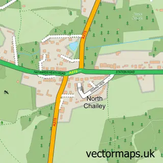
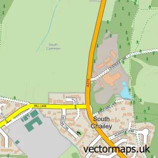
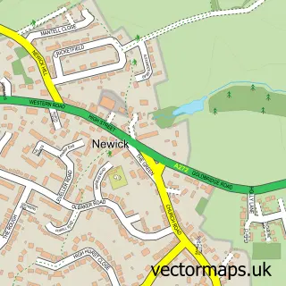
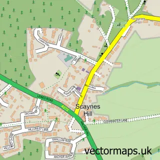
This Chailey street map is a detailed vector street map covering a 750m x 750m area. Select a larger area to create and download your own vector street map of Chailey.
The 750-metre map sample for Chailey covers 41 mapped buildings and approximately 4.3 km of road detail, of which 1 named road are named. The immediate area includes 1 school, 1 GP surgery within 2 miles and 2 pubs. The wider area around Chailey features 2 tourism points of interest, 2 food and drink venues and 3 campsites within 2 miles. To create a larger or custom map of Chailey, the map builder lets you define your own coverage area and download editable SVG, PDF and PNG files.
Create a larger editable map of Chailey
Choose any area you need and generate a high-quality vector map instantly. Perfect for print, planning, design, business and personal use.

This Chailey street map in East Sussex is available as downloadable SVG, PDF and PNG map files, or as a printed map for planning, business, display, education, local information and design work. You can also create a larger custom map area using the map selector.
What this Chailey map sample shows
Chailey lies within Chailey Cp parish, part of Chailey, Barcombe & Hamsey ward in the Lewes District local authority area. The postcode geography for this area includes the BN postcode area, the BN8 postcode district and the BN8 4 postcode sector. Residents fall under the Nhs Sussex Integrated Care Board for NHS services.
Local features near Chailey
Within 2 milesAmenities and services in and around Chailey.
Administrative and postcode information for Chailey
Chailey lies within Chailey Cp parish, part of Chailey, Barcombe & Hamsey ward in the Lewes District local authority area. The postcode geography for this area includes the BN postcode area, the BN8 postcode district and the BN8 4 postcode sector. Residents fall under the Nhs Sussex Integrated Care Board for NHS services.
Nearby street map samples around Chailey

More street maps in East Sussex
750 metre map area coverage
Boundary, postcode and point of interest information for the 750m x 750m rectangle centred on this sample map.
Boundaries containing map centre
Constituency: East Grinstead and Uckfield Co Const
County: East Sussex County
District: Lewes District
Icb: NHS Surrey and Sussex ICB
Parish: Chailey CP
Police Force: sussex
Postcode District: BN8
Postcode Sector: BN8 4
Ward: Chailey, Barcombe & Hamsey Ward
Nearby boundaries intersecting sample
No additional intersecting boundaries found.
Postcode coverage
POI category counts
Landmark And Historical Building: 2
Pub: 2
Anglican Church: 1
Automotive Parts And Accessories: 1
Charity Organization: 1
Church Cathedral: 1
Clothing Store: 1
Elementary School: 1
Industrial Equipment: 1
Metal Supplier: 1
Sample points of interest
- St Peter
- Master of Bumpers Ltd
- Careers at Chailey Heritage Foundation
- St Peters Church Chailey
- Sussex Hat Hire
- St Peters C of E Primary School
- Palehouse Groundcare
- Chailey Green
- Chailey Litter Picking Community Group
- Forge the Way
- SHELL
- Toddlers Inn Children's Nursery
Create a larger editable map of Chailey
This sample shows only a 750 metre area. To create a larger map of Chailey, use our map builder to choose your own coverage area, add titles and download editable SVG, PDF and PNG files.
Create a custom map of Chailey