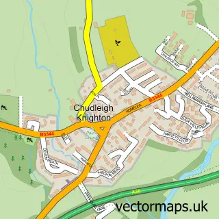
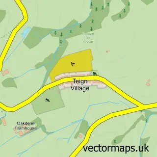
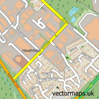
This Chudleigh street map is a detailed vector street map covering a 750m x 750m area. Select a larger area to create and download your own vector street map of Chudleigh.
The 750-metre map sample for Chudleigh covers 526 mapped buildings and approximately 18.4 km of road detail, of which 33 named roads are named. The immediate area includes 1 school, 6 pubs and 1 MOT station, with 2 within 2 miles. The wider area around Chudleigh features 2 tourism points of interest, 10 food and drink venues and 1 hotel. To create a larger or custom map of Chudleigh, the map builder lets you define your own coverage area and download editable SVG, PDF and PNG files.
Create a larger editable map of Chudleigh
Choose any area you need and generate a high-quality vector map instantly. Perfect for print, planning, design, business and personal use.

This Chudleigh street map in Devon is available as downloadable SVG, PDF and PNG map files, or as a printed map for planning, business, display, education, local information and design work. You can also create a larger custom map area using the map selector.
What this Chudleigh map sample shows
Chudleigh lies within Chudleigh Cp parish, part of Chudleigh ward in the Teignbridge District local authority area. The postcode geography for this area includes the TQ postcode area, the TQ13 postcode district and the TQ13 0 postcode sector. Residents fall under the Nhs Devon Integrated Care Board for NHS services.
Local features near Chudleigh
Within 2 milesAmenities and services in and around Chudleigh.
Administrative and postcode information for Chudleigh
Chudleigh lies within Chudleigh Cp parish, part of Chudleigh ward in the Teignbridge District local authority area. The postcode geography for this area includes the TQ postcode area, the TQ13 postcode district and the TQ13 0 postcode sector. Residents fall under the Nhs Devon Integrated Care Board for NHS services.
Nearby street map samples around Chudleigh

More street maps in Devon
750 metre map area coverage
Boundary, postcode and point of interest information for the 750m x 750m rectangle centred on this sample map.
Boundaries containing map centre
Constituency: Central Devon Co Const
County: Devon County
District: Teignbridge District
Icb: NHS Devon ICB
Parish: Chudleigh CP
Police Force: devon and cornwall
Postcode District: TQ13
Postcode Sector: TQ13 0
Ward: Chudleigh Ward
Nearby boundaries intersecting sample
No additional intersecting boundaries found.
Postcode coverage
POI category counts
Beauty Salon: 7
Real Estate Agent: 7
Pub: 6
Financial Service: 4
Beauty And Spa: 3
Counseling And Mental Health: 3
Professional Services: 3
Advertising Agency: 2
Bakery: 2
Barber: 2
Sample points of interest
- Churchill Associates
- Falcon Direct Marketing
- St Martin and St Mary
- The Cooperative Food (BF) Chudleigh, Market Way
- Chudleigh Old Bakery
- Sugarplum Desserts and Deli UK LTD
- Lloyds Bank
- Chudleigh Barbers
- Evolution Barbers
- Beautique
- HiBrow Ink
- The Permanent Make Up Studio
Create a larger editable map of Chudleigh
This sample shows only a 750 metre area. To create a larger map of Chudleigh, use our map builder to choose your own coverage area, add titles and download editable SVG, PDF and PNG files.
Create a custom map of Chudleigh