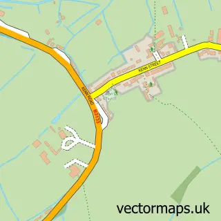
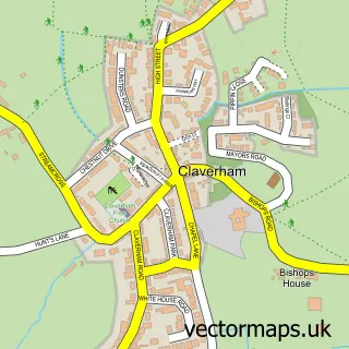
This Clevedon street map is a detailed vector street map covering a 750m x 750m area. Select a larger area to create and download your own vector street map of Clevedon.
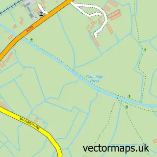
The 750-metre map sample for Clevedon covers 428 mapped buildings and approximately 20.7 km of road detail, of which 45 named roads are named. The immediate area includes 1 school, 1 GP surgery within 2 miles, 3 pubs and 2 MOT stations, with 9 within 2 miles. The wider area around Clevedon features 1 tourism point of interest and 13 food and drink venues. To create a larger or custom map of Clevedon, the map builder lets you define your own coverage area and download editable SVG, PDF and PNG files.
Create a larger editable map of Clevedon
Choose any area you need and generate a high-quality vector map instantly. Perfect for print, planning, design, business and personal use.

This Clevedon street map in Somerset is available as downloadable SVG, PDF and PNG map files, or as a printed map for planning, business, display, education, local information and design work. You can also create a larger custom map area using the map selector.
What this Clevedon map sample shows
Clevedon lies within Clevedon Cp parish, part of Clevedon East ward in the North Somerset local authority area. The postcode geography for this area includes the BS postcode area, the BS21 postcode district and the BS21 7 postcode sector. Residents fall under the Nhs Bristol, North Somerset And South Gloucestershire Integrated Care Board for NHS services.
Local features near Clevedon
Within 2 milesAmenities and services in and around Clevedon.
Administrative and postcode information for Clevedon
Clevedon lies within Clevedon Cp parish, part of Clevedon East ward in the North Somerset local authority area. The postcode geography for this area includes the BS postcode area, the BS21 postcode district and the BS21 7 postcode sector. Residents fall under the Nhs Bristol, North Somerset And South Gloucestershire Integrated Care Board for NHS services.
Nearby street map samples around Clevedon

More street maps in Somerset
750 metre map area coverage
Boundary, postcode and point of interest information for the 750m x 750m rectangle centred on this sample map.
Boundaries containing map centre
Constituency: North Somerset Co Const
District: North Somerset
Icb: NHS Bristol North Somerset and South Gloucestershire ICB
Parish: Clevedon CP
Police Force: avon and somerset
Postcode District: BS21
Postcode Sector: BS21 6
Ward: Clevedon East Ward
Nearby boundaries intersecting sample
Postcode Sector: BS21 7
Ward: Clevedon South Ward, Clevedon Walton Ward, Clevedon West Ward
Postcode coverage
POI category counts
Beauty Salon: 14
Professional Services: 9
Automotive Repair: 8
Barber: 6
Church Cathedral: 6
Hair Salon: 6
Retirement Home: 6
Building Supply Store: 5
Flowers And Gifts Shop: 5
Retail: 5
Sample points of interest
- Phoenix Tax
- Clevedon Lawn Tennis Club
- St John the Evangelist
- Brunelcare
- Mind Charity Shop
- Clevedon Domestics
- Splash Gallery
- Nicky's Atelier
- Seasons Art Class
- S & D Works
- Spinning Weal
- Splash Gallery
Create a larger editable map of Clevedon
This sample shows only a 750 metre area. To create a larger map of Clevedon, use our map builder to choose your own coverage area, add titles and download editable SVG, PDF and PNG files.
Create a custom map of Clevedon