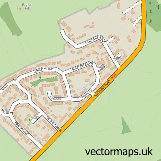
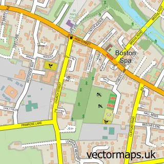
This Collingham street map is a detailed vector street map covering a 750m x 750m area. Select a larger area to create and download your own vector street map of Collingham.
The 750-metre map sample for Collingham covers 454 mapped buildings and approximately 17.1 km of road detail, of which 31 named roads are named. The immediate area includes 1 school, 1 GP surgery, with 2 within 2 miles, 2 pubs and 1 MOT station within 2 miles. The wider area around Collingham features 1 tourism point of interest and 4 food and drink venues. To create a larger or custom map of Collingham, the map builder lets you define your own coverage area and download editable SVG, PDF and PNG files.
Create a larger editable map of Collingham
Choose any area you need and generate a high-quality vector map instantly. Perfect for print, planning, design, business and personal use.

This Collingham street map in West Yorkshire is available as downloadable SVG, PDF and PNG map files, or as a printed map for planning, business, display, education, local information and design work. You can also create a larger custom map area using the map selector.
What this Collingham map sample shows
Collingham lies within Collingham Cp parish, part of Harewood ward in the Leeds District (B) local authority area. The postcode geography for this area includes the LS postcode area, the LS22 postcode district and the LS22 5 postcode sector. Residents fall under the Nhs West Yorkshire Integrated Care Board for NHS services.
Local features near Collingham
Within 2 milesAmenities and services in and around Collingham.
Administrative and postcode information for Collingham
Collingham lies within Collingham Cp parish, part of Harewood ward in the Leeds District (B) local authority area. The postcode geography for this area includes the LS postcode area, the LS22 postcode district and the LS22 5 postcode sector. Residents fall under the Nhs West Yorkshire Integrated Care Board for NHS services.
Nearby street map samples around Collingham
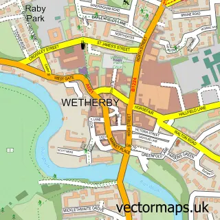

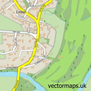
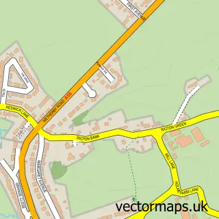
More street maps in West Yorkshire
750 metre map area coverage
Boundary, postcode and point of interest information for the 750m x 750m rectangle centred on this sample map.
Boundaries containing map centre
Constituency: Wetherby and Easingwold Co Const
District: Leeds District (B)
Icb: NHS West Yorkshire ICB
Parish: Collingham CP
Police Force: west yorkshire
Postcode District: LS22
Postcode Sector: LS22 5
Ward: Harewood Ward
Nearby boundaries intersecting sample
No additional intersecting boundaries found.
Postcode coverage
POI category counts
Beauty Product Supplier: 3
Courier And Delivery Services: 2
Dentist: 2
Elementary School: 2
Pub: 2
Shipping Center: 2
Advertising Agency: 1
Anglican Church: 1
Arts And Crafts: 1
Automotive: 1
Sample points of interest
- Mediahouse Marketing & Advertising
- Collingham: St Oswald's Church
- Hunter's Greeting Cards
- Old Star Garage Collingham
- The Old Star Garage
- The Skincare and Beauty Room
- All About Hair
- Clarins Village Pharmacy Collingham
- Michael Pearson Hairdresser
- Revive Beauty and Tanning
- Collingham Bridge
- Collingham Electrical
Create a larger editable map of Collingham
This sample shows only a 750 metre area. To create a larger map of Collingham, use our map builder to choose your own coverage area, add titles and download editable SVG, PDF and PNG files.
Create a custom map of Collingham