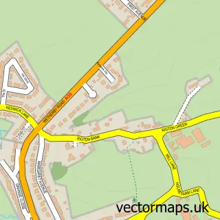
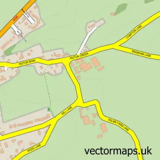
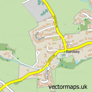
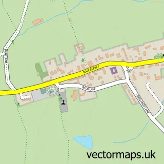
This Rigton Hill street map is a detailed vector street map covering a 750m x 750m area. Select a larger area to create and download your own vector street map of Rigton Hill.
The 750-metre map sample for Rigton Hill covers 216 mapped buildings and approximately 9.3 km of road detail, of which 15 named roads are named. The immediate area includes 1 GP surgery within 2 miles. To create a larger or custom map of Rigton Hill, the map builder lets you define your own coverage area and download editable SVG, PDF and PNG files.
Create a larger editable map of Rigton Hill
Choose any area you need and generate a high-quality vector map instantly. Perfect for print, planning, design, business and personal use.

This Rigton Hill street map in West Yorkshire is available as downloadable SVG, PDF and PNG map files, or as a printed map for planning, business, display, education, local information and design work. You can also create a larger custom map area using the map selector.
What this Rigton Hill map sample shows
Rigton Hill lies within Bardsey Cum Rigton Cp parish, part of Harewood ward in the Leeds District (B) local authority area. The postcode geography for this area includes the LS postcode area, the LS17 postcode district and the LS17 9 postcode sector. Residents fall under the Nhs West Yorkshire Integrated Care Board for NHS services.
Local features near Rigton Hill
Within 2 milesAmenities and services in and around Rigton Hill.
Administrative and postcode information for Rigton Hill
The local authority covering Rigton Hill is Leeds District (B), within the county of West Yorkshire. The settlement lies within Harewood ward and Bardsey Cum Rigton Cp civil parish. The LS17 postcode district and LS17 9 postcode sector serve the immediate area. NHS provision in the area is delivered through Harrogate And District Nhs Foundation Trust.
Nearby street map samples around Rigton Hill

More street maps in West Yorkshire
750 metre map area coverage
Boundary, postcode and point of interest information for the 750m x 750m rectangle centred on this sample map.
Boundaries containing map centre
Constituency: Wetherby and Easingwold Co Const
District: Leeds District (B)
Icb: NHS West Yorkshire ICB
Parish: Bardsey cum Rigton CP
Police Force: west yorkshire
Postcode District: LS17
Postcode Sector: LS17 9
Ward: Harewood Ward
Nearby boundaries intersecting sample
Parish: Collingham CP
Postcode District: LS22
Postcode Sector: LS22 5
Postcode coverage
POI category counts
Advertising Agency: 2
Accountant: 1
Architect: 1
Art Gallery: 1
Builders: 1
Building Supply Store: 1
Carpet Store: 1
Electrician: 1
Financial Advising: 1
Home Developer: 1
Sample points of interest
- FJB Accounting Ltd
- Abyss Marketing
- Abyss Marketing
- Davis Weatherill Partnership Charted Acrhitects
- Art by Rachel
- Hard Builders
- JMA Landscaping Services
- Amazing Floors Yorkshire
- Andale Electrical Ltd
- David F Hook Insurance Brokers
- Jaimemillardproperty
- Ultrabet
Create a larger editable map of Rigton Hill
This sample shows only a 750 metre area. To create a larger map of Rigton Hill, use our map builder to choose your own coverage area, add titles and download editable SVG, PDF and PNG files.
Create a custom map of Rigton Hill