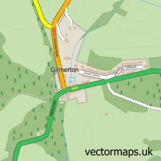
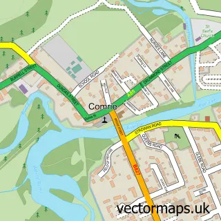
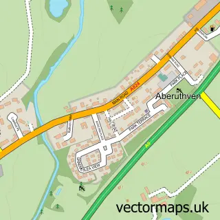
This Crieff street map is a detailed vector street map covering a 750m x 750m area. Select a larger area to create and download your own vector street map of Crieff.
The 750-metre map sample for Crieff covers 204 mapped buildings and approximately 22.8 km of road detail, of which 62 named roads are named. The immediate area includes 2 GP surgeries, 3 pubs and 3 MOT stations, with 5 within 2 miles. The wider area around Crieff features 2 tourism points of interest, 18 food and drink venues and 9 hotels. To create a larger or custom map of Crieff, the map builder lets you define your own coverage area and download editable SVG, PDF and PNG files.
Create a larger editable map of Crieff
Choose any area you need and generate a high-quality vector map instantly. Perfect for print, planning, design, business and personal use.

This Crieff street map in Perth and Kinross is available as downloadable SVG, PDF and PNG map files, or as a printed map for planning, business, display, education, local information and design work. You can also create a larger custom map area using the map selector.
What this Crieff map sample shows
Crieff lies within Perth And Kinross parish, part of Strathearn ward in the Perth And Kinross local authority area. The postcode geography for this area includes the PH postcode area, the PH7 postcode district and the PH7 4 postcode sector. Residents fall under the Tayside for NHS services.
Local features near Crieff
Within 2 milesAmenities and services in and around Crieff.
Administrative and postcode information for Crieff
Crieff lies within Perth And Kinross parish, part of Strathearn ward in the Perth And Kinross local authority area. The postcode geography for this area includes the PH postcode area, the PH7 postcode district and the PH7 4 postcode sector. Residents fall under the Tayside for NHS services.
Nearby street map samples around Crieff

More street maps in Perth and Kinross
750 metre map area coverage
Boundary, postcode and point of interest information for the 750m x 750m rectangle centred on this sample map.
Boundaries containing map centre
Constituency: Perth and Kinross-shire Co Const
District: Perth and Kinross
Icb: Tayside
Postcode District: PH7
Postcode Sector: PH7 3
Ward: Strathearn Ward
Nearby boundaries intersecting sample
Postcode Sector: PH7 4
Postcode coverage
POI category counts
Hotel: 9
Restaurant: 8
Convenience Store: 7
Flowers And Gifts Shop: 6
Automotive Repair: 5
Beauty Salon: 5
Indian Restaurant: 5
Art Gallery: 4
Banks: 4
Beauty And Spa: 4
Sample points of interest
- MMG Chartered Accountants (Previously Finlaysons)
- Cyclecrieff
- Nick Brewster Art and Antiques
- Mckenzie Strickland Associates
- 1743 (Crieff) Squadron Air Training Corps
- Aiton Fine Art
- The Spence Gallery
- The Strathearn Gallery
- This Is It Universe
- Cute as a Button
- Pretoria Public House
- Ashdene Court
Create a larger editable map of Crieff
This sample shows only a 750 metre area. To create a larger map of Crieff, use our map builder to choose your own coverage area, add titles and download editable SVG, PDF and PNG files.
Create a custom map of Crieff