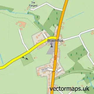
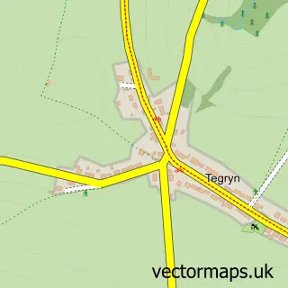
This Crymych street map is a detailed vector street map covering a 750m x 750m area. Select a larger area to create and download your own vector street map of Crymych.
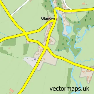
The 750-metre map sample for Crymych covers 187 mapped buildings and approximately 7.9 km of road detail, of which 5 named roads are named. The immediate area includes 1 GP surgery, 1 pub and 2 MOT stations within 2 miles. The wider area around Crymych features 2 food and drink venues. To create a larger or custom map of Crymych, the map builder lets you define your own coverage area and download editable SVG, PDF and PNG files.
Create a larger editable map of Crymych
Choose any area you need and generate a high-quality vector map instantly. Perfect for print, planning, design, business and personal use.

This Crymych street map in Dyfed is available as downloadable SVG, PDF and PNG map files, or as a printed map for planning, business, display, education, local information and design work. You can also create a larger custom map area using the map selector.
What this Crymych map sample shows
Crymych lies within Crymych Community parish, part of Crymych ward in the Sir Benfro - Pembrokeshire local authority area. The postcode geography for this area includes the SA postcode area, the SA41 postcode district and the SA41 3 postcode sector. Residents fall under the Hywel Dda University Health Board for NHS services.
Local features near Crymych
Within 2 milesAmenities and services in and around Crymych.
Administrative and postcode information for Crymych
Crymych lies within Crymych Community parish, part of Crymych ward in the Sir Benfro - Pembrokeshire local authority area. The postcode geography for this area includes the SA postcode area, the SA41 postcode district and the SA41 3 postcode sector. Residents fall under the Hywel Dda University Health Board for NHS services.
Nearby street map samples around Crymych

More street maps in Dyfed
750 metre map area coverage
Boundary, postcode and point of interest information for the 750m x 750m rectangle centred on this sample map.
Boundaries containing map centre
Constituency: Ceredigion Preseli Co Const
District: Sir Benfro - Pembrokeshire
Icb: Hywel Dda
Parish: Crymych Community
Police Force: dyfed-powys
Postcode District: SA41
Postcode Sector: SA41 3
Nearby boundaries intersecting sample
No additional intersecting boundaries found.
Postcode coverage
POI category counts
Building Supply Store: 4
Bakery: 3
Beauty Salon: 2
Fish And Chips Restaurant: 2
Gas Station: 2
Korean Grocery Store: 2
Wedding Planning: 2
Agricultural Cooperatives: 1
Amateur Sports Team: 1
Appliance Manufacturer: 1
Sample points of interest
- W H James
- Silent auction for Crymych RFC under 16's
- Mary's Farmhouse
- C J's Artwork
- JJ Morris Furniture Auctions
- Composites Cymru
- J K Lewis & Son
- JK Lewis & Son
- Mary's Farmhouse
- Liam Harries Barbers
- Delwedd Beauty Salon
- House of Eden
Create a larger editable map of Crymych
This sample shows only a 750 metre area. To create a larger map of Crymych, use our map builder to choose your own coverage area, add titles and download editable SVG, PDF and PNG files.
Create a custom map of Crymych