This Boncath street map is a detailed vector street map covering a 750m x 750m area. Select a larger area to create and download your own vector street map of Boncath.
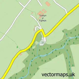
The 750-metre map sample for Boncath covers 111 mapped buildings and approximately 6.2 km of road detail. The wider area around Boncath features 1 hotel and 2 campsites within 2 miles. To create a larger or custom map of Boncath, the map builder lets you define your own coverage area and download editable SVG, PDF and PNG files.
Create a larger editable map of Boncath
Choose any area you need and generate a high-quality vector map instantly. Perfect for print, planning, design, business and personal use.

This Boncath street map in Dyfed is available as downloadable SVG, PDF and PNG map files, or as a printed map for planning, business, display, education, local information and design work. You can also create a larger custom map area using the map selector.
What this Boncath map sample shows
Boncath lies within Boncath Community parish, part of Clydau ward in the Sir Benfro - Pembrokeshire local authority area. The postcode geography for this area includes the SA postcode area, the SA37 postcode district and the SA37 0 postcode sector. Residents fall under the Hywel Dda University Health Board for NHS services.
Local features near Boncath
Within 2 milesAmenities and services in and around Boncath.
Administrative and postcode information for Boncath
Boncath lies within Boncath Community parish, part of Clydau ward in the Sir Benfro - Pembrokeshire local authority area. The postcode geography for this area includes the SA postcode area, the SA37 postcode district and the SA37 0 postcode sector. Residents fall under the Hywel Dda University Health Board for NHS services.
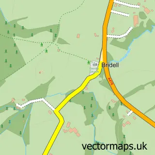
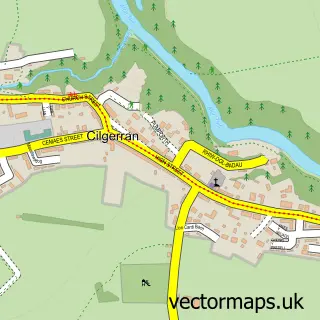
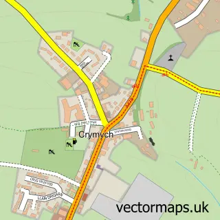
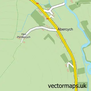
Nearby street map samples around Boncath

More street maps in Dyfed
750 metre map area coverage
Boundary, postcode and point of interest information for the 750m x 750m rectangle centred on this sample map.
Boundaries containing map centre
Constituency: Ceredigion Preseli Co Const
District: Sir Benfro - Pembrokeshire
Icb: Hywel Dda
Parish: Boncath Community
Police Force: dyfed-powys
Postcode District: SA37
Postcode Sector: SA37 0
Nearby boundaries intersecting sample
No additional intersecting boundaries found.
Postcode coverage
POI category counts
Advertising Agency: 1
Building Supply Store: 1
Convenience Store: 1
Gardener: 1
Hotel: 1
Organic Grocery Store: 1
Waterfall: 1
Sample points of interest
- Zodshop
- Aberteifi West Wales Repair Service
- Boncath Post Office
- Llechryd & District Gardening Club
- Plas Pantyderi Manor
- Trioni
- Ffynone Waterfall, Boncath
Create a larger editable map of Boncath
This sample shows only a 750 metre area. To create a larger map of Boncath, use our map builder to choose your own coverage area, add titles and download editable SVG, PDF and PNG files.
Create a custom map of Boncath