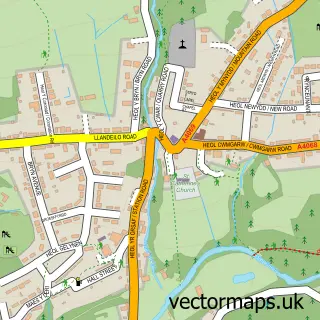
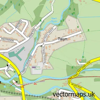
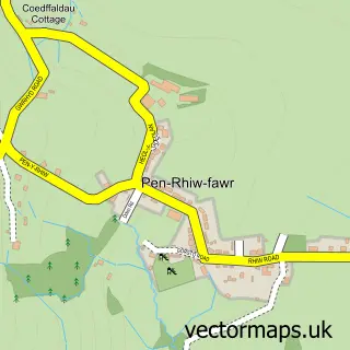
This Cwmgors street map is a detailed vector street map covering a 750m x 750m area. Select a larger area to create and download your own vector street map of Cwmgors.
The 750-metre map sample for Cwmgors covers 181 mapped buildings and approximately 5.4 km of road detail, of which 8 named roads are named. The immediate area includes 1 GP surgery within 2 miles and 1 MOT station within 2 miles. The wider area around Cwmgors features 1 tourism point of interest. To create a larger or custom map of Cwmgors, the map builder lets you define your own coverage area and download editable SVG, PDF and PNG files.
Create a larger editable map of Cwmgors
Choose any area you need and generate a high-quality vector map instantly. Perfect for print, planning, design, business and personal use.

This Cwmgors street map in West Glamorgan is available as downloadable SVG, PDF and PNG map files, or as a printed map for planning, business, display, education, local information and design work. You can also create a larger custom map area using the map selector.
What this Cwmgors map sample shows
Cwmgors lies within Gwaun-Cae-Gurwen Community parish, part of Gwaun-Cae-Gurwen ward in the Castell-Nedd Port Talbot - Neath Port Talbot local authority area. The postcode geography for this area includes the SA postcode area, the SA18 postcode district and the SA18 1 postcode sector. Residents fall under the Swansea Bay University Local Health Board for NHS services.
Local features near Cwmgors
Within 2 milesAmenities and services in and around Cwmgors.
Administrative and postcode information for Cwmgors
Cwmgors lies within Gwaun-Cae-Gurwen Community parish, part of Gwaun-Cae-Gurwen ward in the Castell-Nedd Port Talbot - Neath Port Talbot local authority area. The postcode geography for this area includes the SA postcode area, the SA18 postcode district and the SA18 1 postcode sector. Residents fall under the Swansea Bay University Local Health Board for NHS services.
Nearby street map samples around Cwmgors

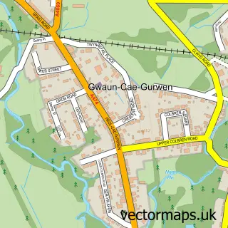
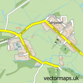
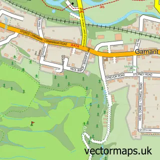
More street maps in West Glamorgan
750 metre map area coverage
Boundary, postcode and point of interest information for the 750m x 750m rectangle centred on this sample map.
Boundaries containing map centre
Constituency: Brecon, Radnor and Cwm Tawe Co Const
District: Castell-nedd Port Talbot - Neath Port Talbot
Icb: Abertawe Bro Morgannwg University
Parish: Gwaun-Cae-Gurwen Community
Police Force: south wales
Postcode District: SA18
Postcode Sector: SA18 1
Nearby boundaries intersecting sample
Constituency: Caerfyrddin Co Const
District: Sir Gaerfyrddin - Carmarthenshire
Icb: Hywel Dda
Parish: Cwmamman Community
Police Force: dyfed-powys
Postcode coverage
POI category counts
Auto Electrical Repair: 1
Beauty Salon: 1
Cupcake Shop: 1
Elementary School: 1
Engineering Services: 1
Landmark And Historical Building: 1
Landscaping: 1
School: 1
Sample points of interest
- Jacksons Electrical Services
- Indulgence Beauty Salon
- With a cherry on top
- Cwmgorse Primary School
- Direct GRP Solutions Ltd.
- Cwmgors
- Trimtree Tree Services
- Ysgol G.G.D. Cwmgors
Create a larger editable map of Cwmgors
This sample shows only a 750 metre area. To create a larger map of Cwmgors, use our map builder to choose your own coverage area, add titles and download editable SVG, PDF and PNG files.
Create a custom map of Cwmgors