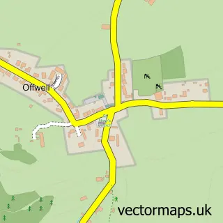
This Dalwood street map is a detailed vector street map covering a 750m x 750m area. Select a larger area to create and download your own vector street map of Dalwood.
The 750-metre map sample for Dalwood covers 82 mapped buildings and approximately 4.6 km of road detail, of which 5 named roads are named. The immediate area includes 2 pubs. The wider area around Dalwood features 2 food and drink venues and 1 campsite within 2 miles. To create a larger or custom map of Dalwood, the map builder lets you define your own coverage area and download editable SVG, PDF and PNG files.
Create a larger editable map of Dalwood
Choose any area you need and generate a high-quality vector map instantly. Perfect for print, planning, design, business and personal use.

This Dalwood street map in Devon is available as downloadable SVG, PDF and PNG map files, or as a printed map for planning, business, display, education, local information and design work. You can also create a larger custom map area using the map selector.
What this Dalwood map sample shows
Dalwood lies within Dalwood Cp parish, part of Newbridges ward in the East Devon District local authority area. The postcode geography for this area includes the EX postcode area, the EX13 postcode district and the EX13 7 postcode sector. Residents fall under the Nhs Devon Integrated Care Board for NHS services.
Local features near Dalwood
Within 2 milesAmenities and services in and around Dalwood.
Administrative and postcode information for Dalwood
Dalwood lies within Dalwood Cp parish, part of Newbridges ward in the East Devon District local authority area. The postcode geography for this area includes the EX postcode area, the EX13 postcode district and the EX13 7 postcode sector. Residents fall under the Nhs Devon Integrated Care Board for NHS services.
Nearby street map samples around Dalwood

More street maps in Devon
750 metre map area coverage
Boundary, postcode and point of interest information for the 750m x 750m rectangle centred on this sample map.
Boundaries containing map centre
Constituency: Honiton and Sidmouth Co Const
County: Devon County
District: East Devon District
Icb: NHS Devon ICB
Parish: Dalwood CP
Police Force: devon and cornwall
Postcode District: EX13
Postcode Sector: EX13 7
Ward: Newbridges Ward
Nearby boundaries intersecting sample
Parish: Stockland CP
Ward: Dunkeswell & Otterhead Ward
Postcode coverage
POI category counts
Pub: 2
Winery: 2
Anglican Church: 1
Chimney Sweep: 1
Garbage Collection Service: 1
Martial Arts Club: 1
Rental Service: 1
Shipping Center: 1
Stadium Arena: 1
Transportation: 1
Sample points of interest
- St Peter's Church, Dalwood
- Stuart's Sweeping Service
- Allclear
- Axminster Combatives & Self-defence
- The Tuckers Arms, Dalwood
- Tuckers Arms
- Seward's Coaches
- Post Office-Dalwood
- Naga Links
- Hillview Cottage
- Dalwood Vineyard
- Dalwood Vineyard
Create a larger editable map of Dalwood
This sample shows only a 750 metre area. To create a larger map of Dalwood, use our map builder to choose your own coverage area, add titles and download editable SVG, PDF and PNG files.
Create a custom map of Dalwood