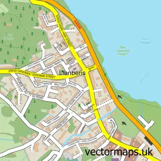
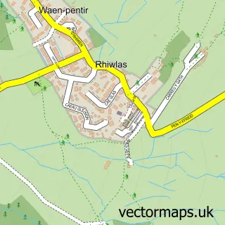
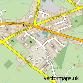
This Deiniolen street map is a detailed vector street map covering a 750m x 750m area. Select a larger area to create and download your own vector street map of Deiniolen.
The 750-metre map sample for Deiniolen covers 208 mapped buildings and approximately 13.0 km of road detail, of which 15 named roads are named. The immediate area includes 1 school, 1 GP surgery, 1 pub and 1 MOT station, with 3 within 2 miles. The wider area around Deiniolen features 1 tourism point of interest, 1 food and drink venue and 1 campsite within 2 miles. To create a larger or custom map of Deiniolen, the map builder lets you define your own coverage area and download editable SVG, PDF and PNG files.
Create a larger editable map of Deiniolen
Choose any area you need and generate a high-quality vector map instantly. Perfect for print, planning, design, business and personal use.

This Deiniolen street map in Gwynedd is available as downloadable SVG, PDF and PNG map files, or as a printed map for planning, business, display, education, local information and design work. You can also create a larger custom map area using the map selector.
What this Deiniolen map sample shows
Deiniolen lies within Llanddeiniolen Community parish, part of Deiniolen ward in the Gwynedd - Gwynedd local authority area. The postcode geography for this area includes the LL postcode area, the LL55 postcode district and the LL55 3 postcode sector. Residents fall under the Betsi Cadwaladr University Health Board for NHS services.
Local features near Deiniolen
Within 2 milesAmenities and services in and around Deiniolen.
Administrative and postcode information for Deiniolen
Deiniolen lies within Llanddeiniolen Community parish, part of Deiniolen ward in the Gwynedd - Gwynedd local authority area. The postcode geography for this area includes the LL postcode area, the LL55 postcode district and the LL55 3 postcode sector. Residents fall under the Betsi Cadwaladr University Health Board for NHS services.
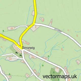
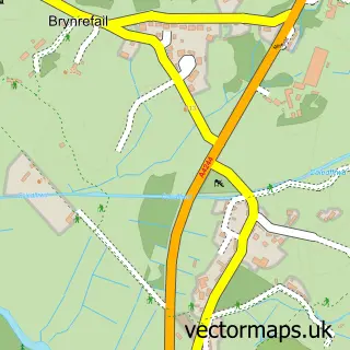
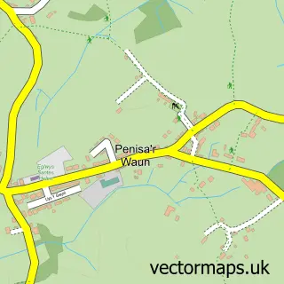
Nearby street map samples around Deiniolen

More street maps in Gwynedd
750 metre map area coverage
Boundary, postcode and point of interest information for the 750m x 750m rectangle centred on this sample map.
Boundaries containing map centre
Constituency: Dwyfor Meirionnydd Co Const
District: Gwynedd - Gwynedd
Icb: Betsi Cadwaladr University
Parish: Llanddeiniolen Community
Police Force: north wales
Postcode District: LL55
Postcode Sector: LL55 3
Nearby boundaries intersecting sample
No additional intersecting boundaries found.
Postcode coverage
POI category counts
Convenience Store: 2
Attractions And Activities: 1
Business Management Services: 1
Courier And Delivery Services: 1
Mass Media: 1
Package Locker: 1
Professional Services: 1
Pub: 1
Supermarket: 1
Sample points of interest
- Summit Guides
- Matrix 10 Ltd.
- Costcutter
- Costcutter Deiniolen | Caernarfon
- Evri ParcelShop
- Xpress Publishing
- InPost
- SportpicturesCymru
- The Wellington
- Costcutter
Create a larger editable map of Deiniolen
This sample shows only a 750 metre area. To create a larger map of Deiniolen, use our map builder to choose your own coverage area, add titles and download editable SVG, PDF and PNG files.
Create a custom map of Deiniolen