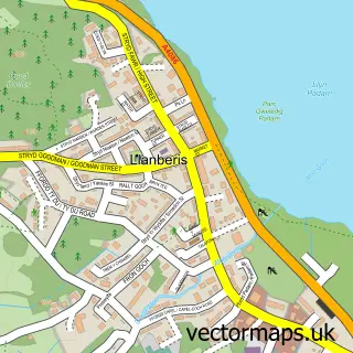
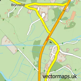
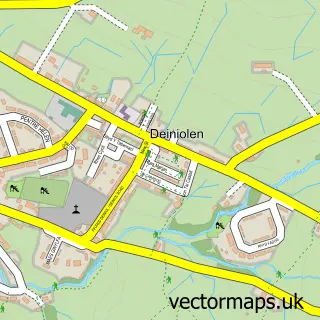
This Llanrug street map is a detailed vector street map covering a 750m x 750m area. Select a larger area to create and download your own vector street map of Llanrug.
The 750-metre map sample for Llanrug covers 352 mapped buildings and approximately 12.2 km of road detail, of which 16 named roads are named. The immediate area includes 1 school, 2 GP surgeries and 2 MOT stations within 2 miles. The wider area around Llanrug features 5 tourism points of interest, 2 food and drink venues and 2 hotels. To create a larger or custom map of Llanrug, the map builder lets you define your own coverage area and download editable SVG, PDF and PNG files.
Create a larger editable map of Llanrug
Choose any area you need and generate a high-quality vector map instantly. Perfect for print, planning, design, business and personal use.

This Llanrug street map in Gwynedd is available as downloadable SVG, PDF and PNG map files, or as a printed map for planning, business, display, education, local information and design work. You can also create a larger custom map area using the map selector.
What this Llanrug map sample shows
Llanrug lies within Llanrug Community parish, part of Llanrug ward in the Gwynedd - Gwynedd local authority area. The postcode geography for this area includes the LL postcode area, the LL55 postcode district and the LL55 4 postcode sector. Residents fall under the Betsi Cadwaladr University Health Board for NHS services.
Local features near Llanrug
Within 2 milesAmenities and services in and around Llanrug.
Administrative and postcode information for Llanrug
The local authority covering Llanrug is Gwynedd - Gwynedd, within the county of Gwynedd. The settlement lies within Llanrug ward and Llanrug Community civil parish. The LL55 postcode district and LL55 4 postcode sector serve the immediate area. NHS provision in the area is delivered through Betsi Cadwaladr University Health Board.
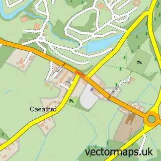
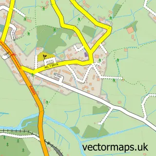
Nearby street map samples around Llanrug

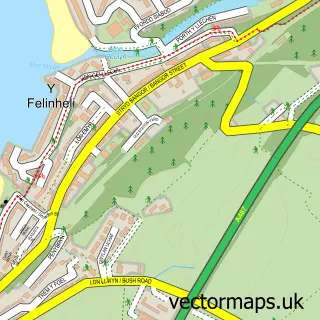
More street maps in Gwynedd
750 metre map area coverage
Boundary, postcode and point of interest information for the 750m x 750m rectangle centred on this sample map.
Boundaries containing map centre
Constituency: Dwyfor Meirionnydd Co Const
District: Gwynedd - Gwynedd
Icb: Betsi Cadwaladr University
Parish: Llanrug Community
Police Force: north wales
Postcode District: LL55
Postcode Sector: LL55 4
Nearby boundaries intersecting sample
Postcode Sector: LL55 2
Postcode coverage
POI category counts
Convenience Store: 5
Campground: 3
Hotel: 2
Atms: 1
Beauty Salon: 1
Butcher Shop: 1
Cafe: 1
Carpenter: 1
Electrician: 1
Event Technology Service: 1
Sample points of interest
- The Cooperative Food Llanrug - Station Road, Llanrug
- Elaine's Hair & Beauty Salon
- Wavells
- Caffi Gwynant Cafe
- Llys Derwen
- Llys Derwen Caravan and Campsite
- Twll Y Clawdd Touring and Camping Park
- Timber Gardens
- Co-op
- Natural
- Premier
- Premier Siop Sgwar Llanrug
Create a larger editable map of Llanrug
This sample shows only a 750 metre area. To create a larger map of Llanrug, use our map builder to choose your own coverage area, add titles and download editable SVG, PDF and PNG files.
Create a custom map of Llanrug